Main route: E ↔ 150m ↑ 100m ⏱ 45min vf / 3h30 total gpx
View details in Romanian.
Thank you Cristi D. (iepu09) for all info below, including photos and gpx track.
Summary
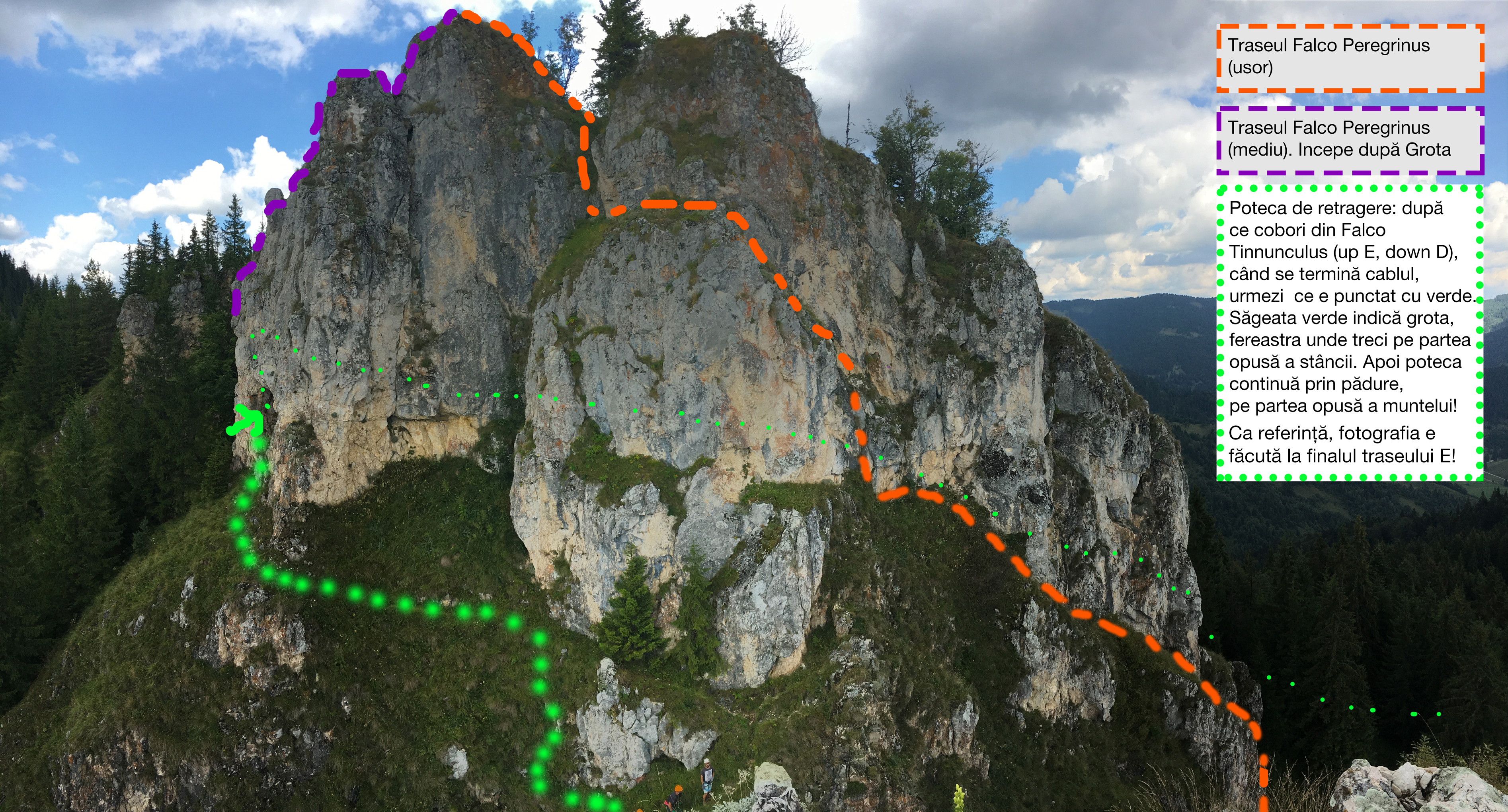
- 3 routes in total: B/C, D, E
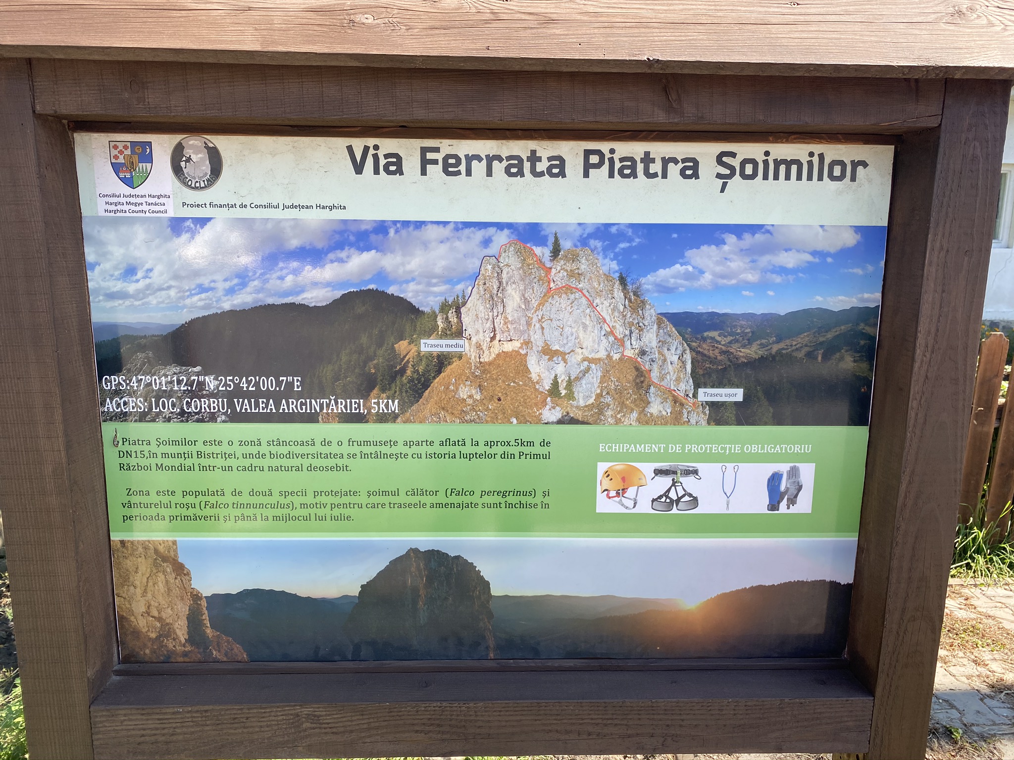
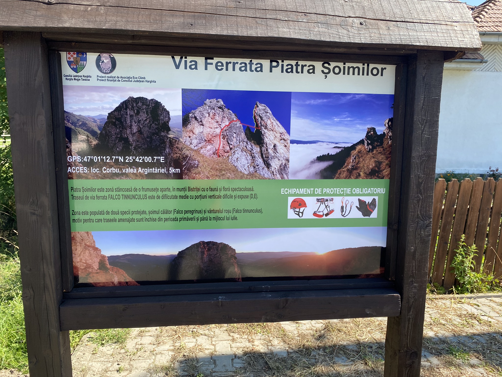
- GPS access: 46°59’29.0″N 25°41’00.7″E or 46.991389,25.683528 (geo)
- Access duration: 1h45
- Via ferrata duration for route E: 45min
- Return duration: 1h-1h30
- Total time: 3h30
- Open from 20th of July until November only, due to this rock being the breeding grounds for Falco Peregrinus – the peregrine falcon, and Falco tinnunculus – the common kestrel.
Piatra Șoimilor is a natural reserve near Corbu village (north of Harghita county). Let’s see at this place as a hidden gem, as there is little information available about it. Located far from any human settlement, where only the falcons fly. Because this remote cliff is in every spring the place where hundreds of falcons nestle (Falco Peregrinus – the peregrine falcon and Falco tinnunculus – the common kestrel). This is also the reason why the access is forbidden until the end of July.
Here there are some superb via ferrata trails: area Falco Pegregrinus – an easy trail estimated B/C and a medium trail estimated D, and the area Falco Tinnunculus – with a special extreme trail E (very difficult). Not even the descent is easier, you have to come down on some short but difficult (estimated D) trail.
Access
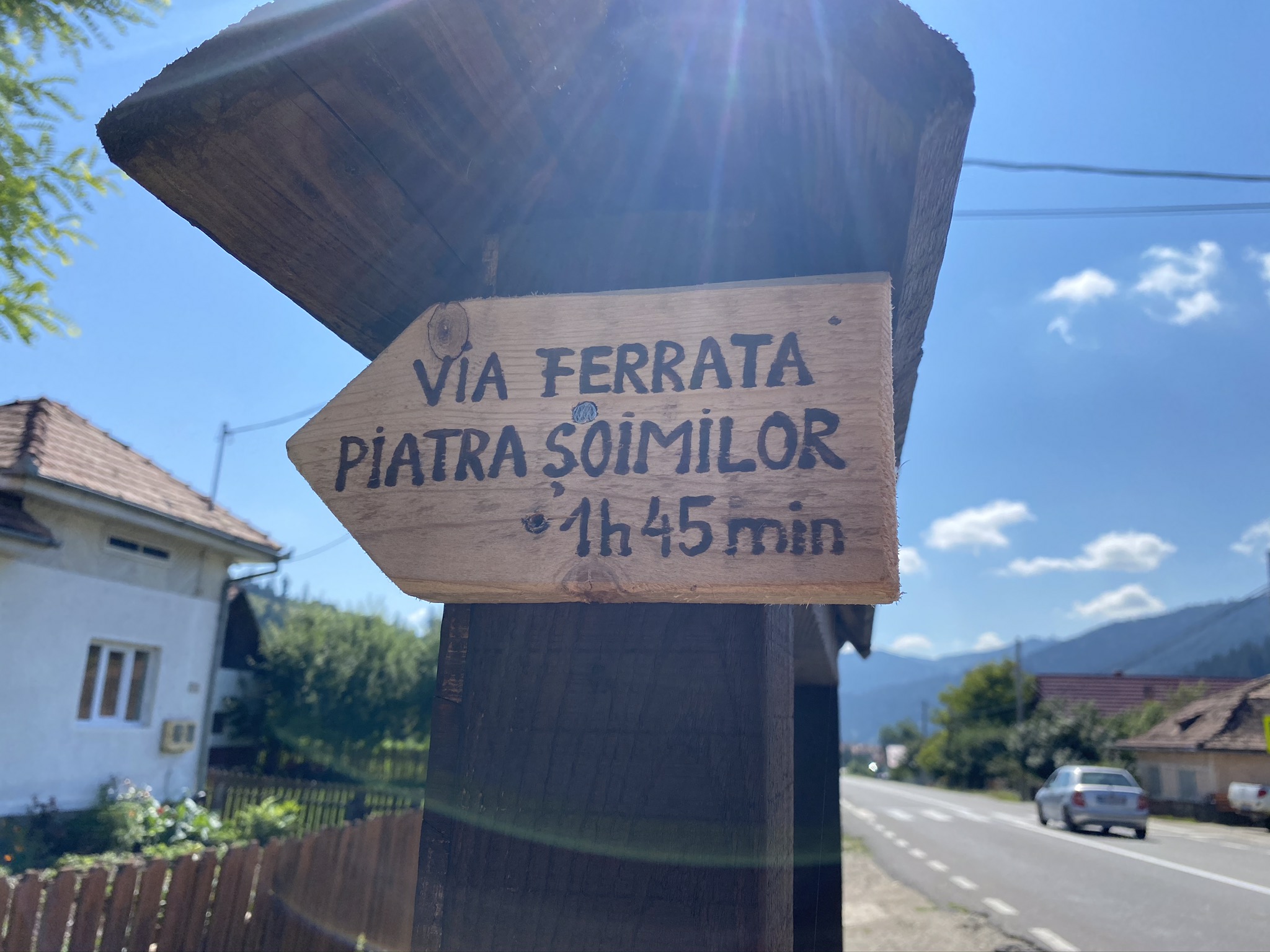
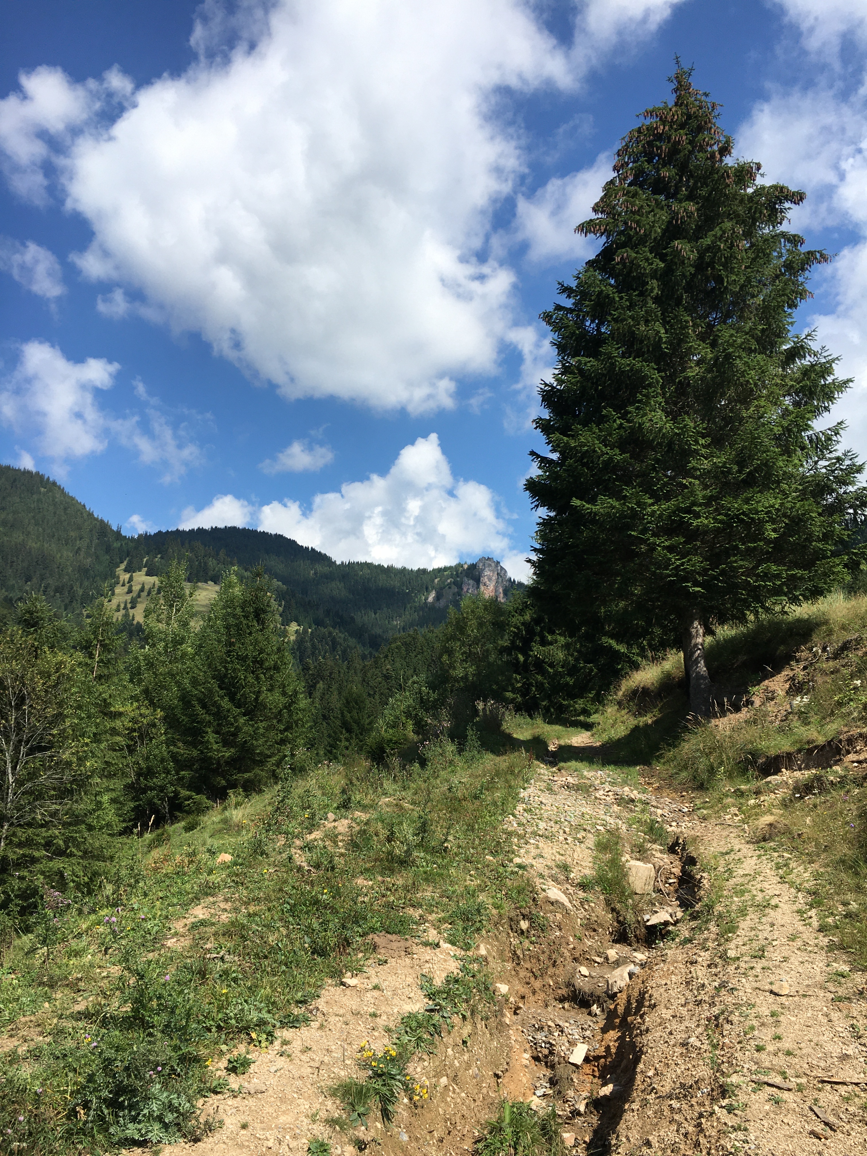
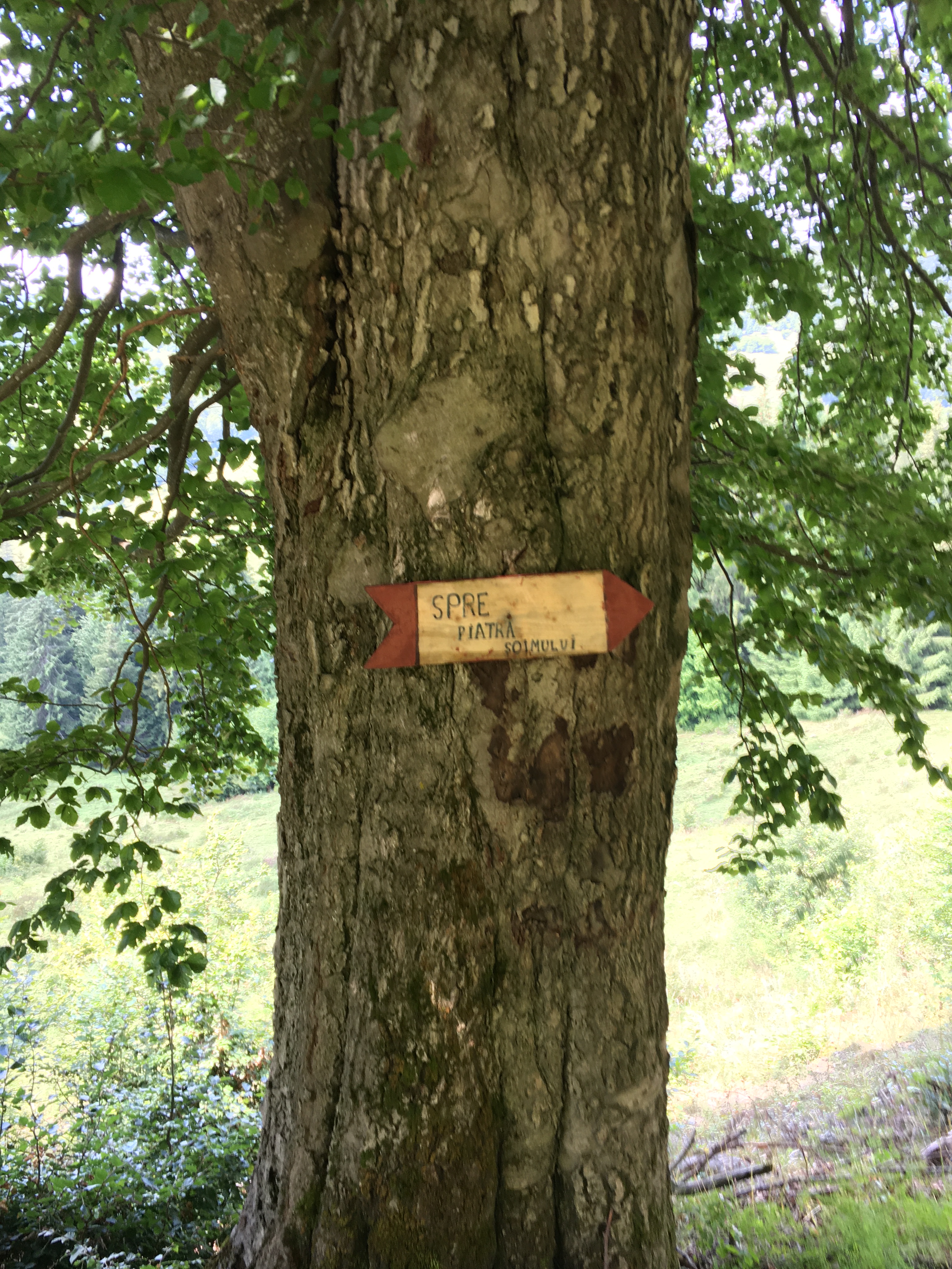
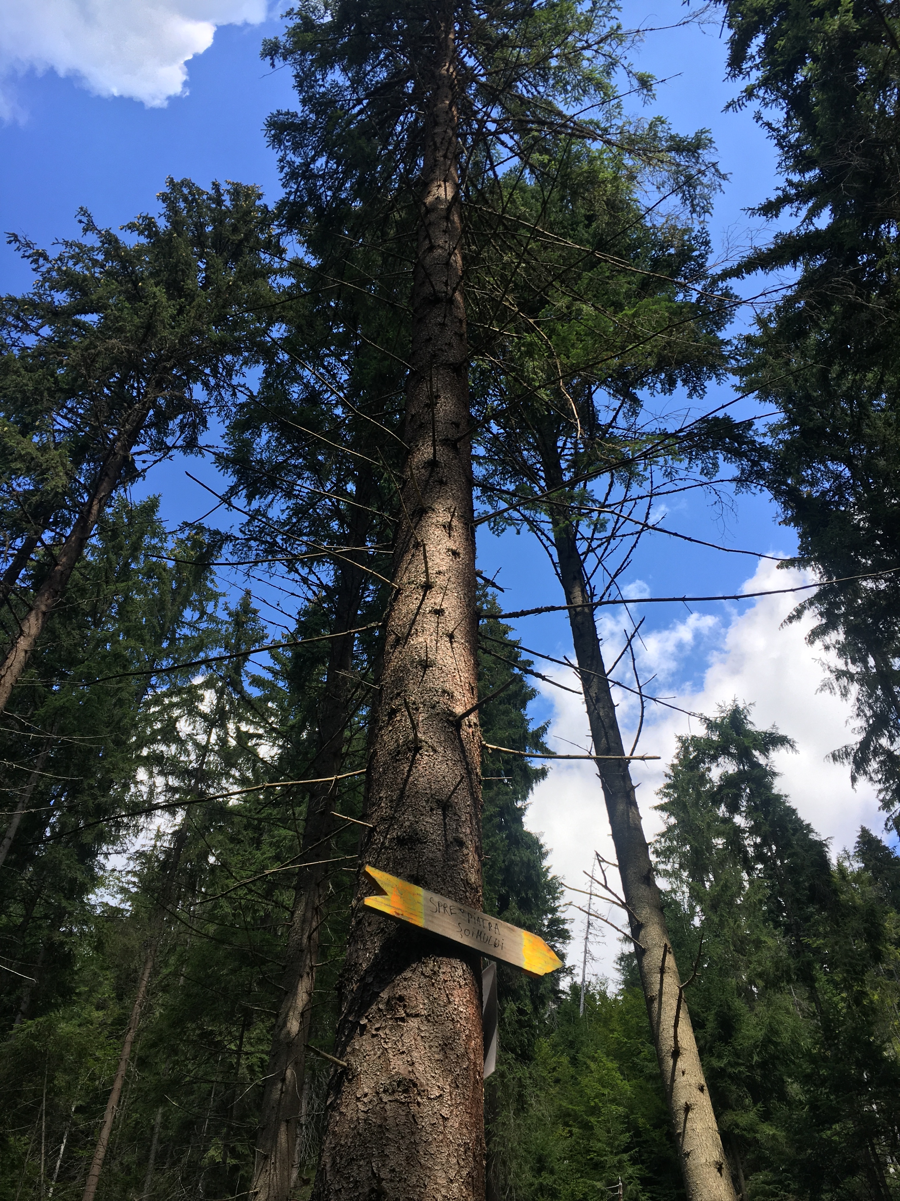
There is no map to find an access. The recommended access is made through Valea Argintăriei. So pay attention to the waypoints. At the beginning of the valley you will see 2 panels and that would be all of it. An indicator states 1h45 up to the cliff. I would say it’s more.
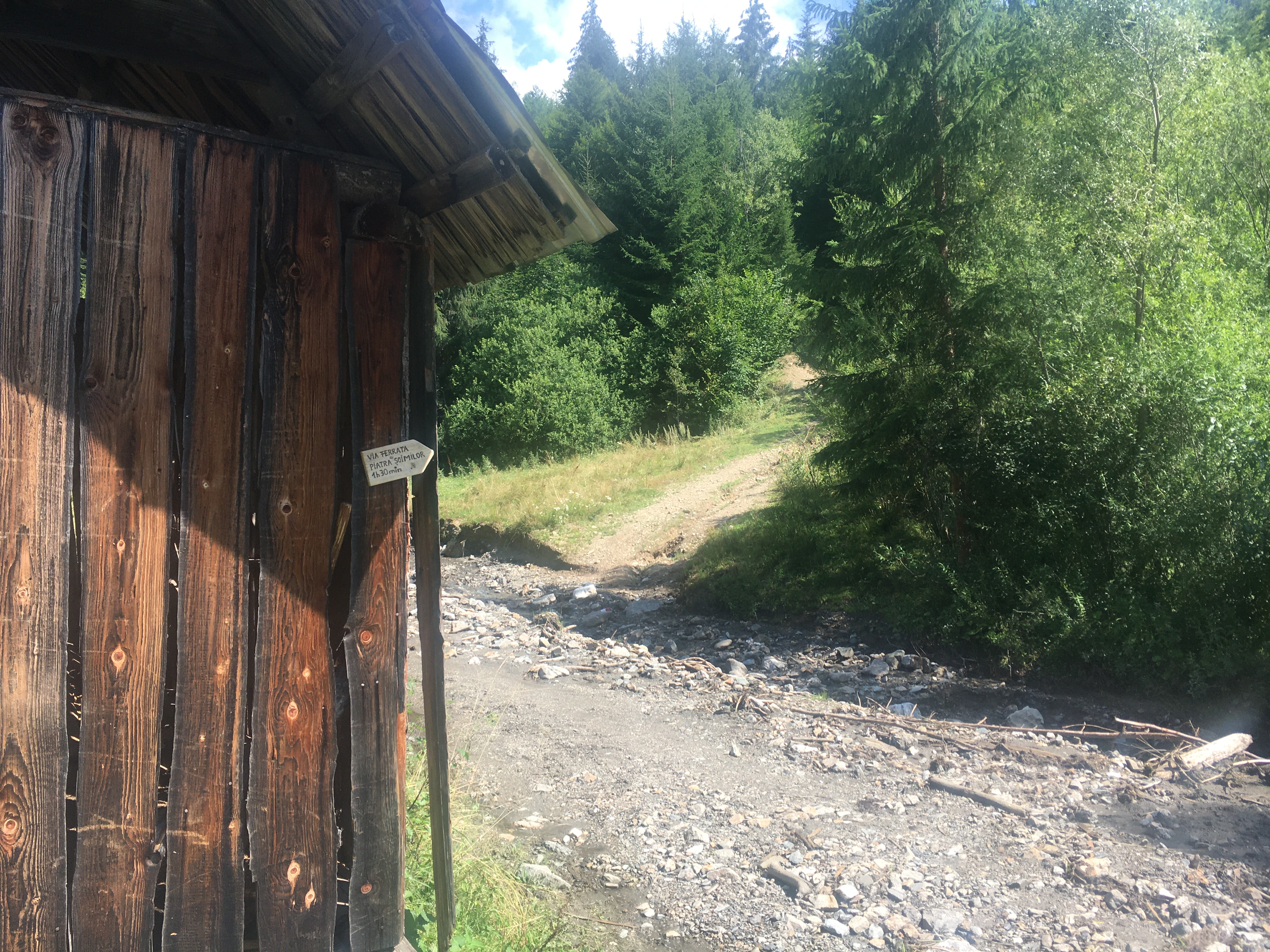
The road (if it can be named road) is very narrow and basically through a river, so would be recommended only if you have a serious 4×4. It’s best you hike up extra 15 minutes from the main road, but if you decide to go by car, at the indicated waypoint, you have to cross the river, and from here only if you are on A/T tires should be advised to continue, if not, start walking up the hill. From here an indicator says 1h30, we did 1h10.
150m after crossing the river, pay attention to the 10 dogs guarding the sheepfold. There is water here. On the trail you will meet from time to time some other indicators (you may also check the gpx track attached).
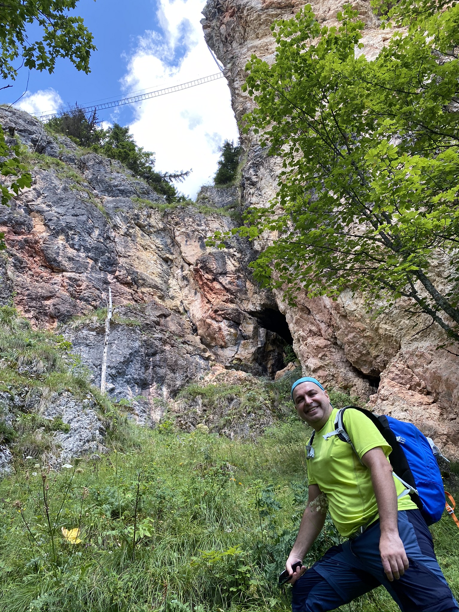
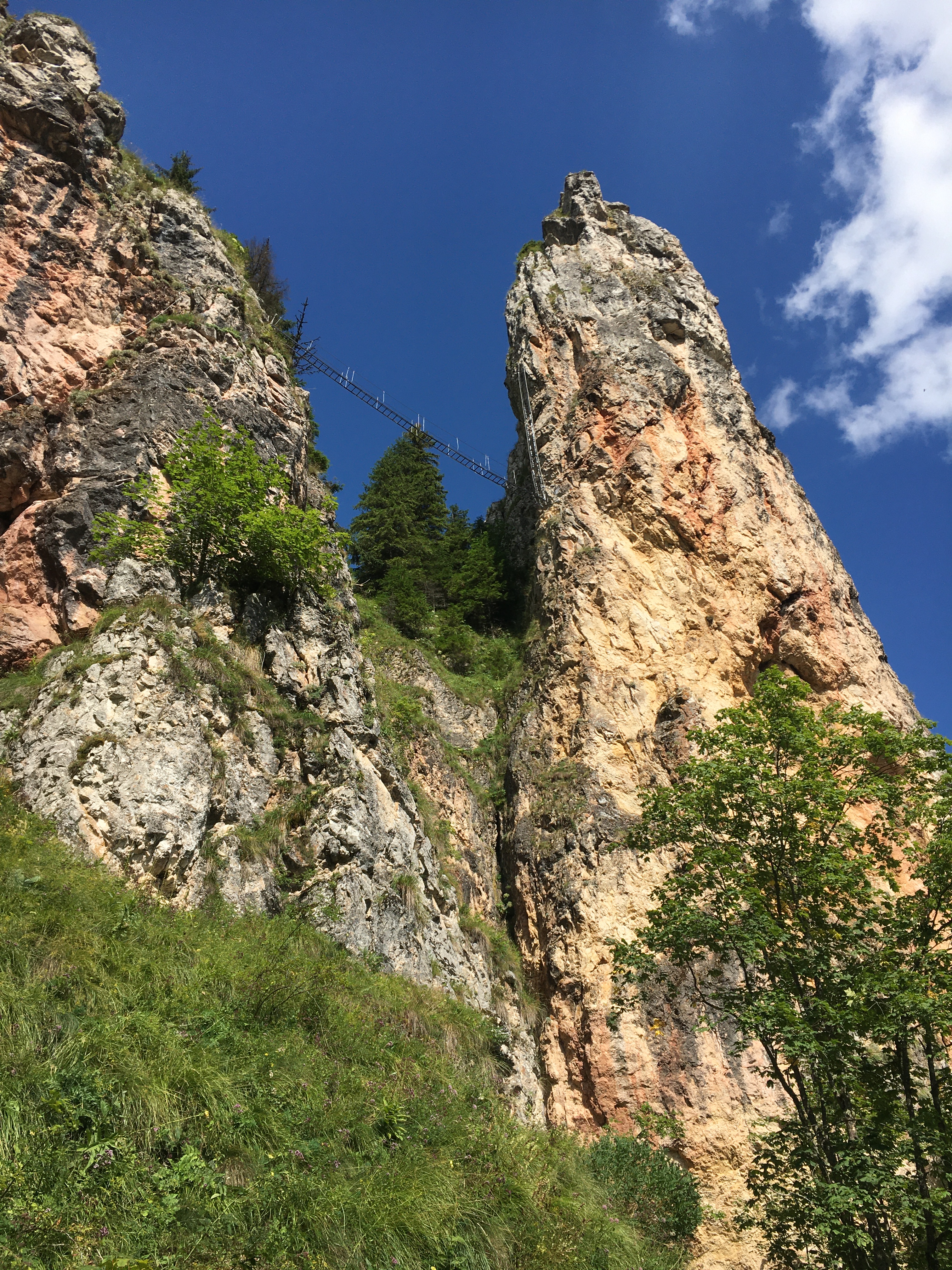
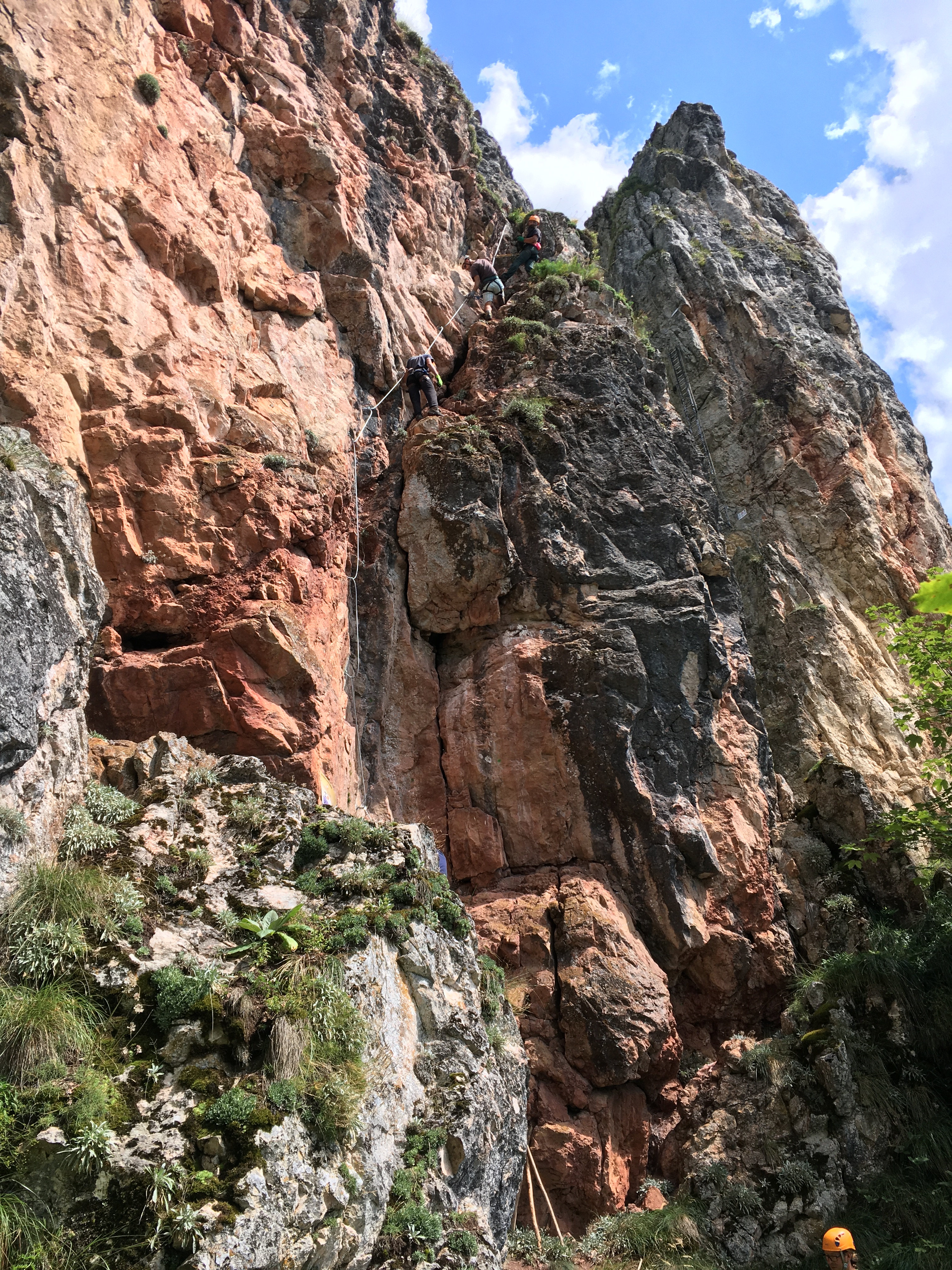
Piatra Șoimilor (Falcons’ Rock)
1h15-1h30 from crossing the river you should be near the cliff. There are 2 options from here:
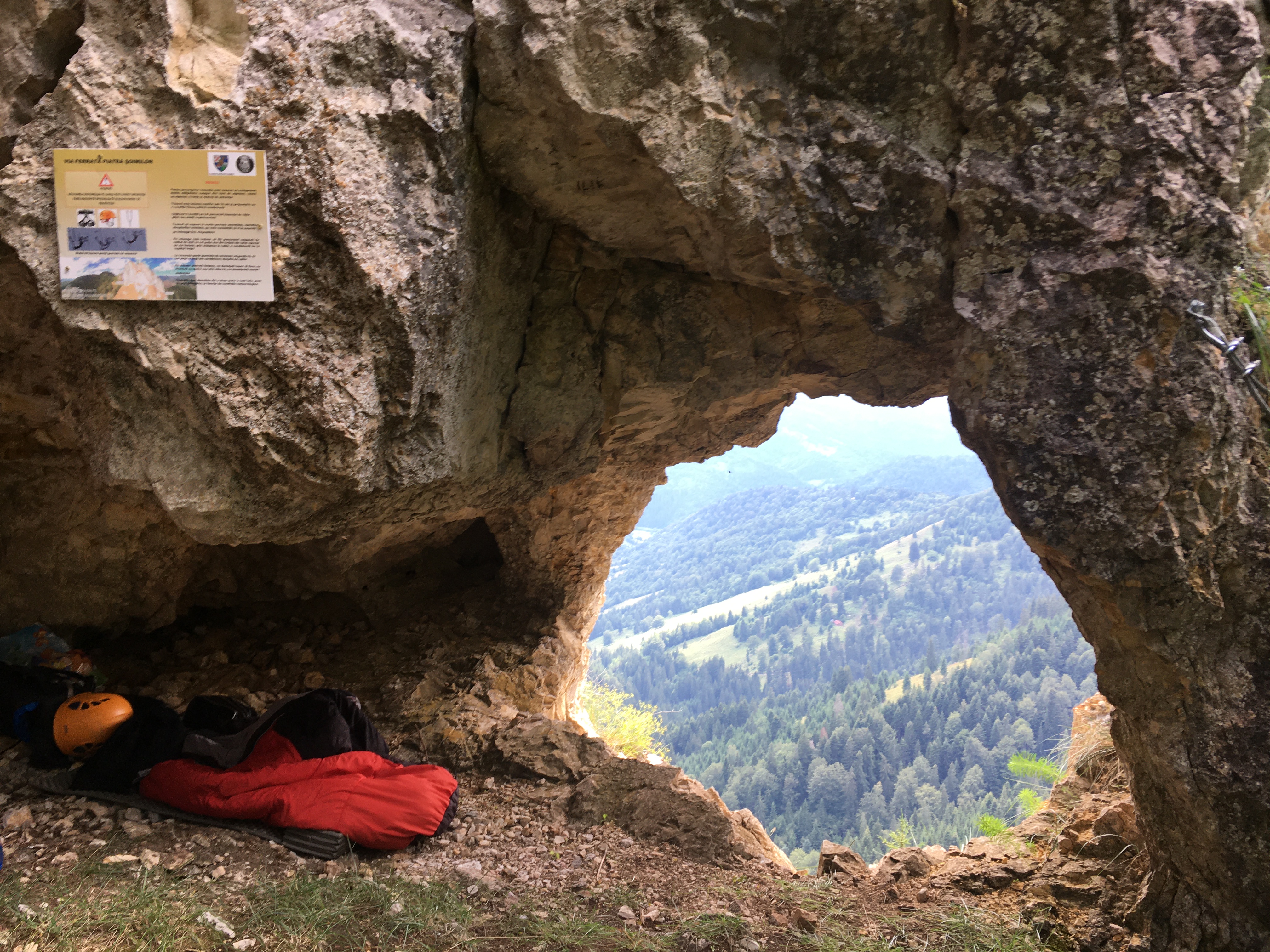
- straight right, upon the yellow striped indicator, walk up the hill, and you get to the start of the ferrata Falco Peregrinus (easy). Further, this trail goes up through the forest on the other side of the cliffs, up to the grotto (window), where the Falco Peregrinus (hard) ferrata begins.
- continue straight and keep the road for a while, then head right up, than right again to reach the area of Falco Tinnunculus ferrata (E).
Via ferratas: 3, free of charge, approach from Corbu approx. 1h45 plus the way back.
- Falco Peregrinus easy : B/C – 45 min
- Falco Peregrinus hard: D – 15 min
- Falco Tinnunculus very hard, difficult: E – 45 min (out of which 10 min is a D estimated descent)
Falco Tinnunculus (E)
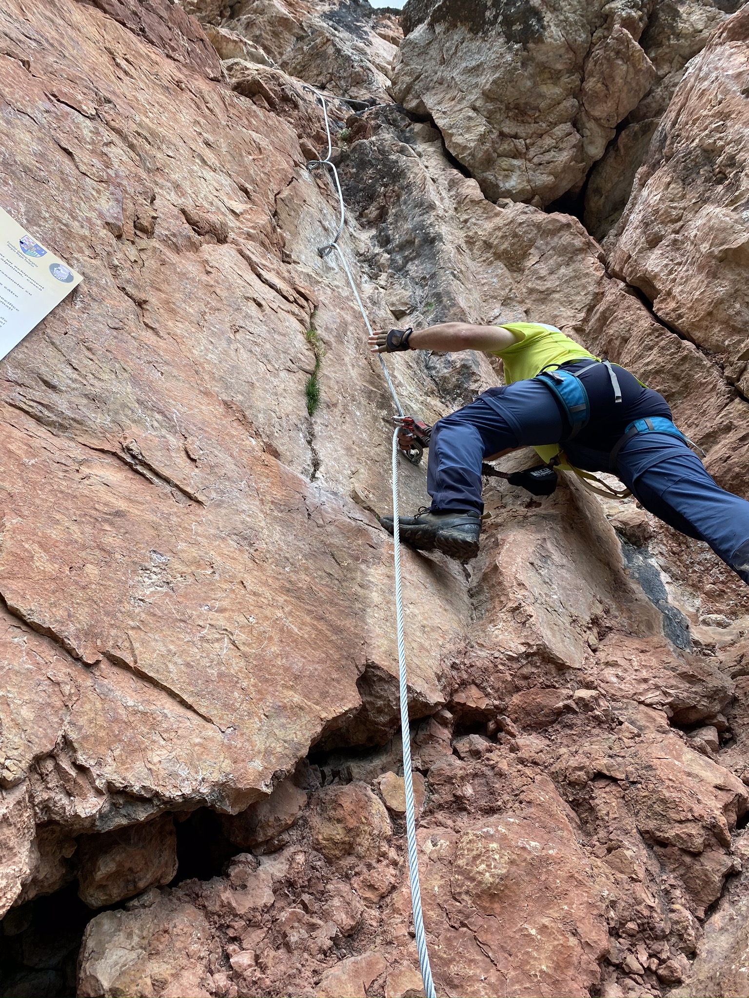
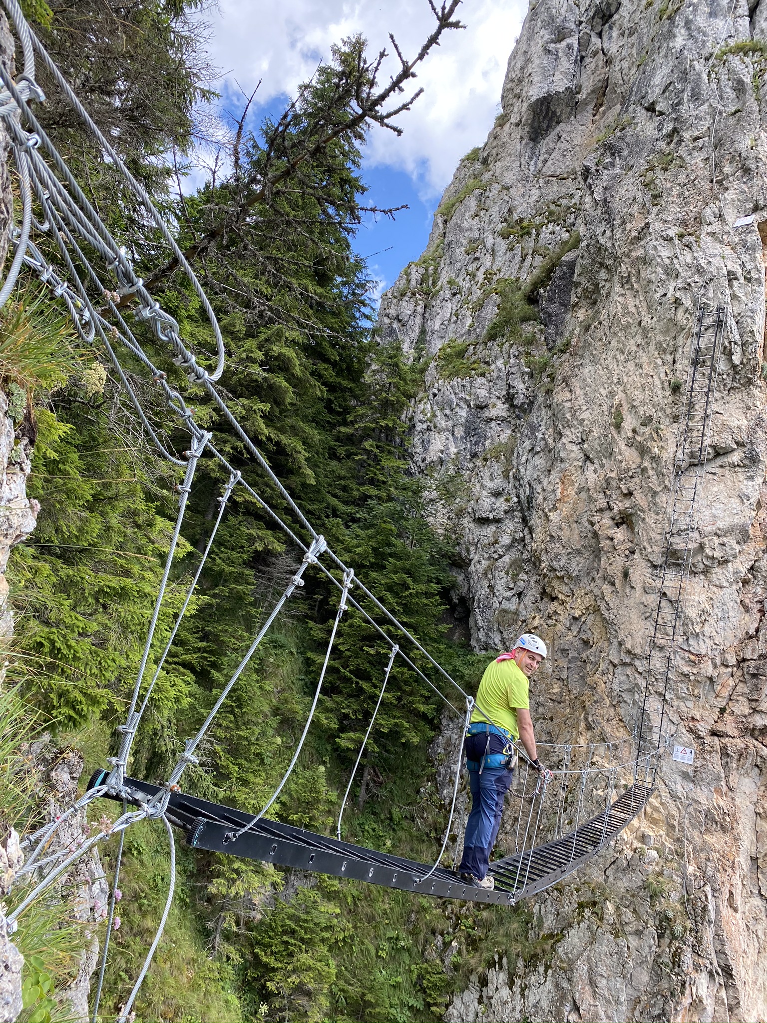
It’s not long (150m long, about 100m altitude gain), but it is strenuous: it starts vertical, and then it’s a bit easier. Then it follows the 15m bridge and the 3 part 15m long stair, which is balancing to the cliff and back. Breathe, because after the stair another strenuous part follows (some 5 m). If you made it till here, the rest should not be a problem. Be careful, the rock is extremely fragile!!! If you have not climbed at least a D, don’t come here! There is no artificial climbing aid, except for the stairs; it’s only the cable and the rock! Be careful, strong arm power is needed!!!
Exit from the route: Pain is not over as the descent is also very difficult, so be very careful. Once you made it alive and left the cable, pay attention: you will see a trail heading to the cliff in front of you. Take it and head left, up to a grotto (window). Go through this portal and on the other side follow the trail, which enters the forest and descent back to the road/trail you came on.
Waypoints
- Start in Corbu: 46°59’29.0″N 25°41’00.7″E (46.991383,25.683533) – the official sign shows 1h45 up to Piatra Șoimilor
- River crossing, potential place to park the car: 47°00’07.2″N 25°41’32.4″E (47.002000, 25.692340) – official sign shows 1h30 up to Piatra Șoimilor
- To the routes: 47°01’11.6″N 25°41’59.2″E (47.019883, 25.699783) – for the easy routes you follow the sign with a yellow band, to the right; for the difficult route you go straight and afterwards towards the base of the rock.
Prices: free.
Return trail: Follow the forest trail back to where you came from.
Mandatory gear: alpine helmet, alpine harness, via ferrata set. Optionally, gloves.
Wheater: Meteoblue Corbu, Harghita / Viewweather Corbu, Harghita.
Emergency calls: +40.SALVAMONT, which is actually +40.725.826.668, or 112, the European all around emergency number. GPS coordinates for localization: 47°01’11.6″N 25°41’59.2″E.
Video
Photos
Sources: