C ↔ 215m ↑ 150m ⏱ 1h vf / 2h total gpx
View details in Romanian.
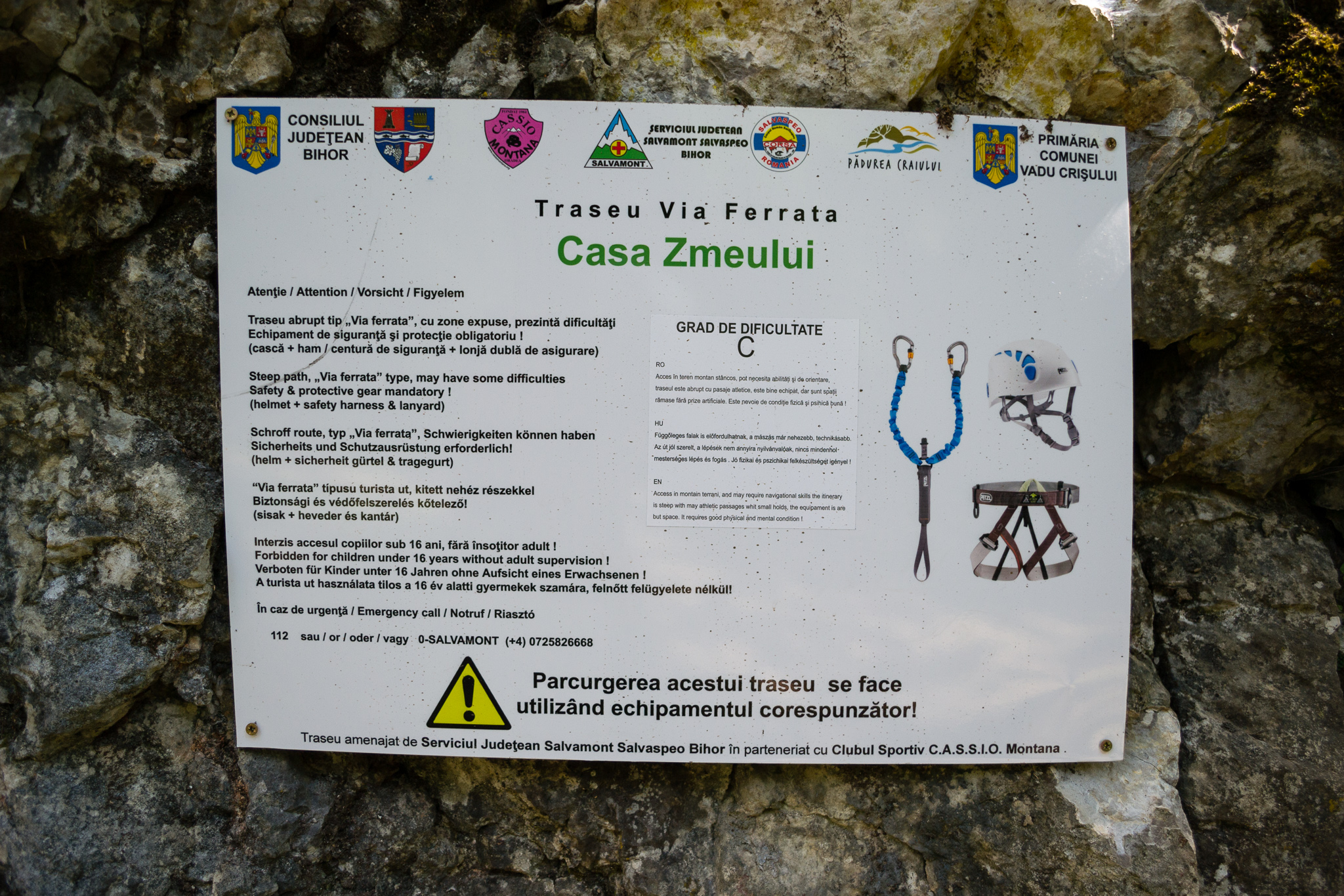
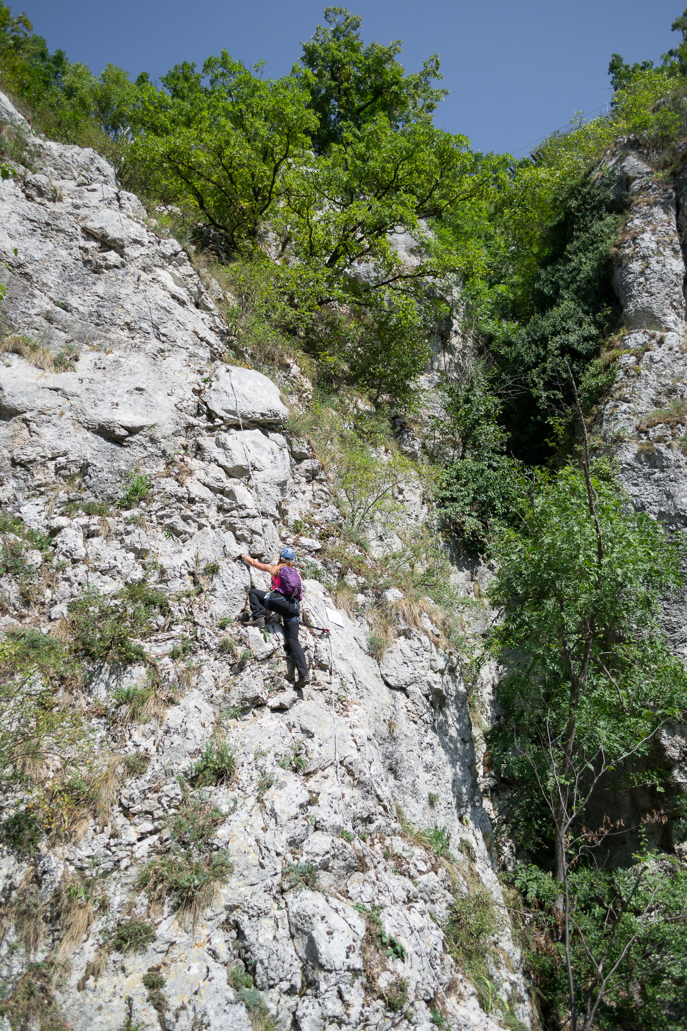
The “Casa Zmeului” via ferrata route was opened in July 2017 near Vadu Crisului, Crisul Repede defile/gorge, in Padurea Craiului Mountains, a subunit of the Apuseni Mountains. The route was built by Salvamont Salvaspeo Bihor, the Romanian mountain rescue unit from Bihor county, with help from CASSIO Montana Bihor club.
Summary:
- GPS track – Wikiloc
- Length 215m
- Vertical climb 150m
- Difficulty C
- GPS access / Parking: 46°58’33.2″N 22°30’27.5″E or 46.974972,22.507750 (geo)
- GPS Start Via Ferrata: 46°58’16.4″N 22°30’48.8″E or 46.971230,22.513550 (geo)
- Access hiking duration: 30 min
- Via ferrata duration: 1h
- Return hiking duration: 30 min
- Total time: 2 hours
- Minimum 16 years old; below 16 years old only accompanied by an experienced adult
- Best time: May – October, except for when it’s rainy and the rocks become slippery
All via ferrata routes in Crisul Repede Defile
- Via Ferrata “Podu Indian” – Șuncuiuș, Bihor (C/D) (English) -
C/D | ↔ 160m | ↑ 80m | ⏱ 30min vf (55min total) - Via Ferrata “Grota cu Hamace” – Șuncuiuș, Bihor (B) (English) -
B | ↔ 170m | ↑ 80m | ⏱ 40min vf (1h05 total) - Via Ferrata “Casa Zmeului” – Vadu Crișului, Bihor (C) (English) -
C | ↔ 215m | ↑ 150m | ⏱ 1h vf (2h total) - Via Ferrata “Mocănița” – Peretele Zânelor, Vadu Crișului, Bihor (B) (English) -
B | ↔ 150m | ↑ 110m | ⏱ 1h+ vf (2h+ total)
Map for this route
On the map above, “P” is parking, the red flags mark the start and end of via ferrata, orange route is for access and green route for the return trail.
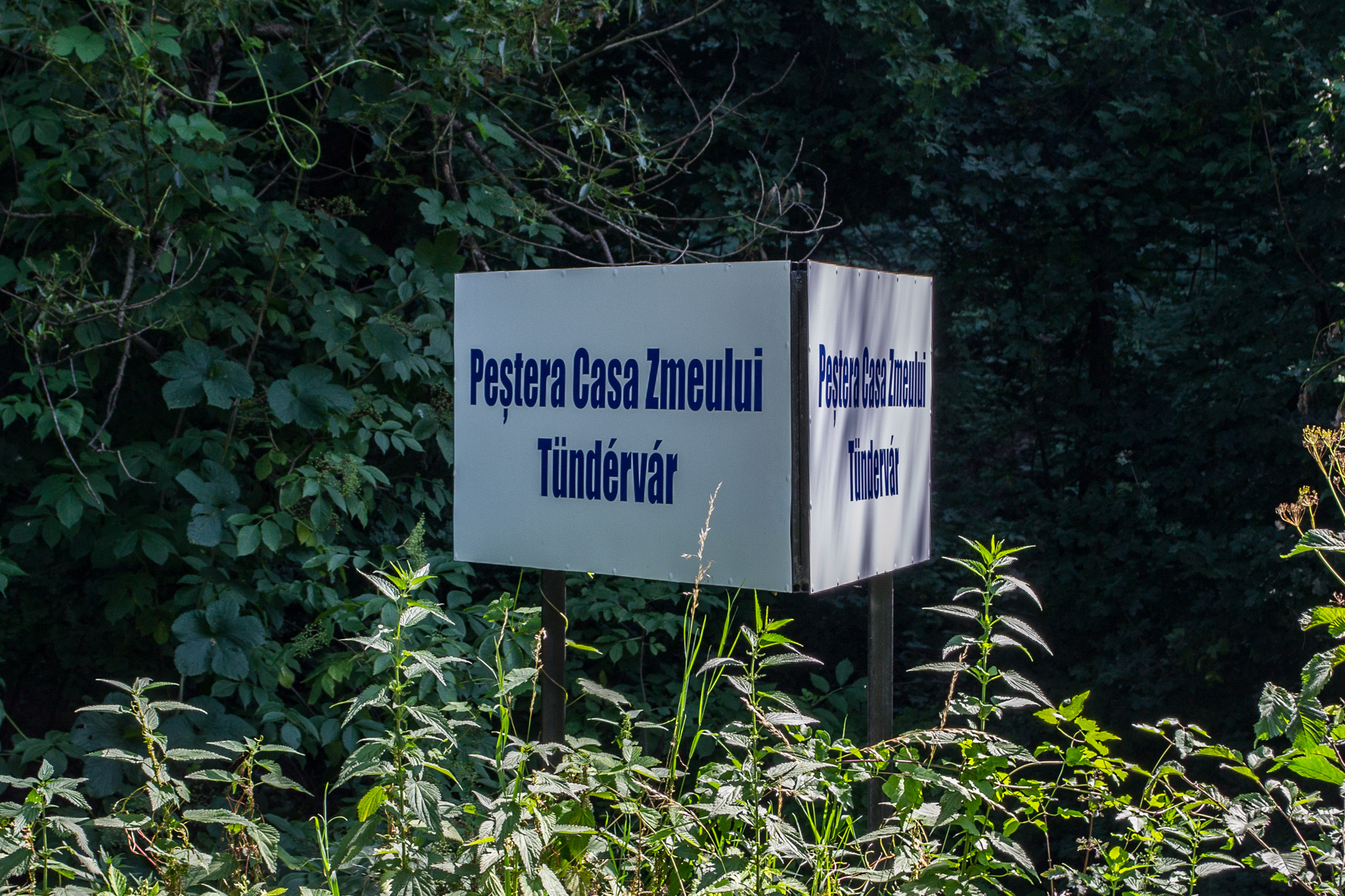
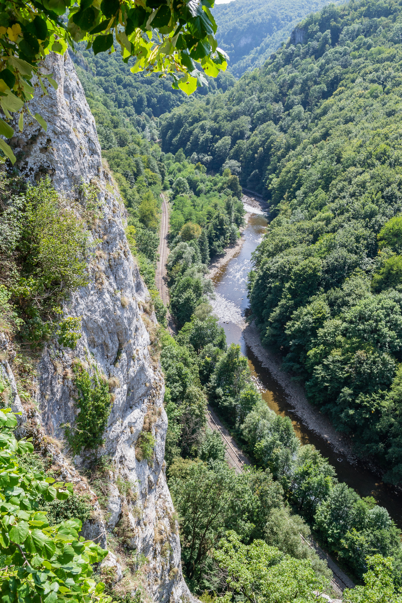
Access: You start near the sports field in Vadu Crisului village (GPS: 46°58’33.2″N 22°30’27.5″E or 46.975900,22.507648). The shortest route is by following a narrow track alongside the railroad, which crosses the defile. You’ll reach a sign saying “Pestera Casa Zmeului”, which means “Dragon’s House Cave”, more or less. Make a left here towards the base of the stone wall and you’ll see the via ferrata cable after just a few meters.
(If you continue alongside the railroad, you can reach the other via ferrata route in Vadu Crisului, (B) “Mocanita”.)
Length of via ferrata route: 215m. Vertical climb: 140-150m.
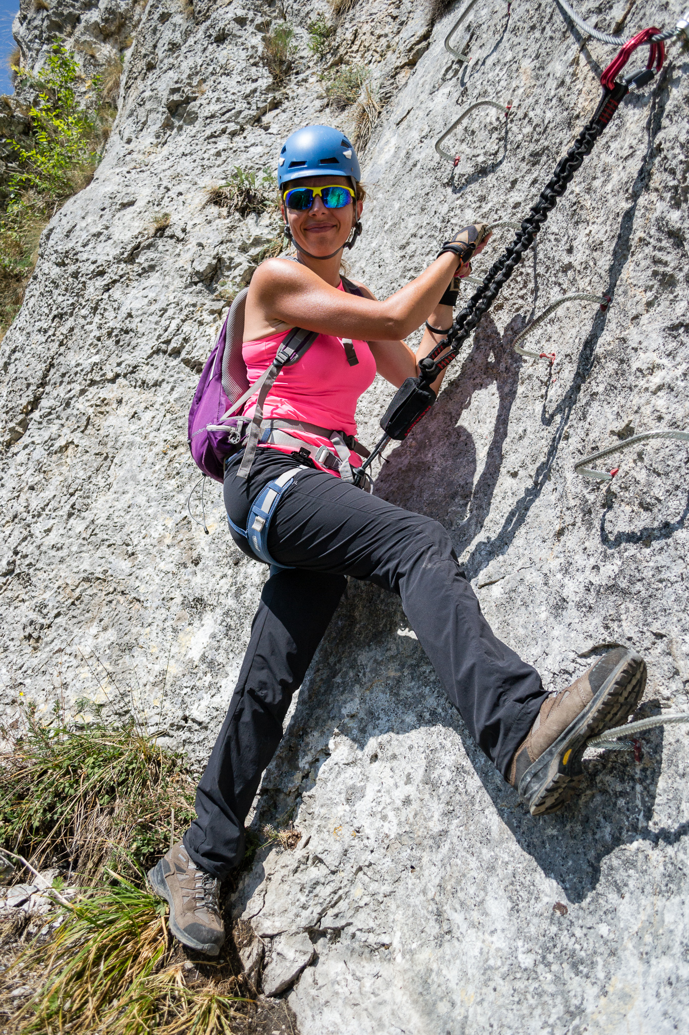
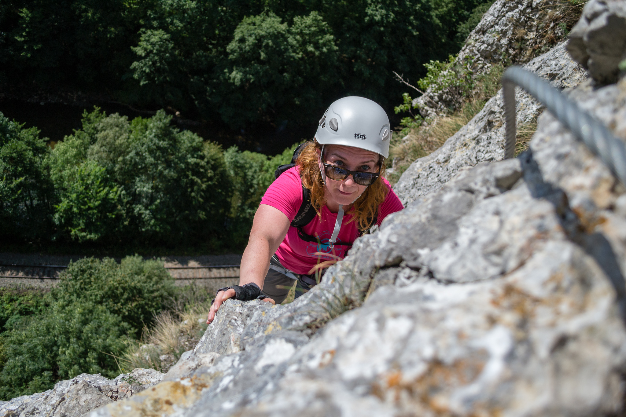
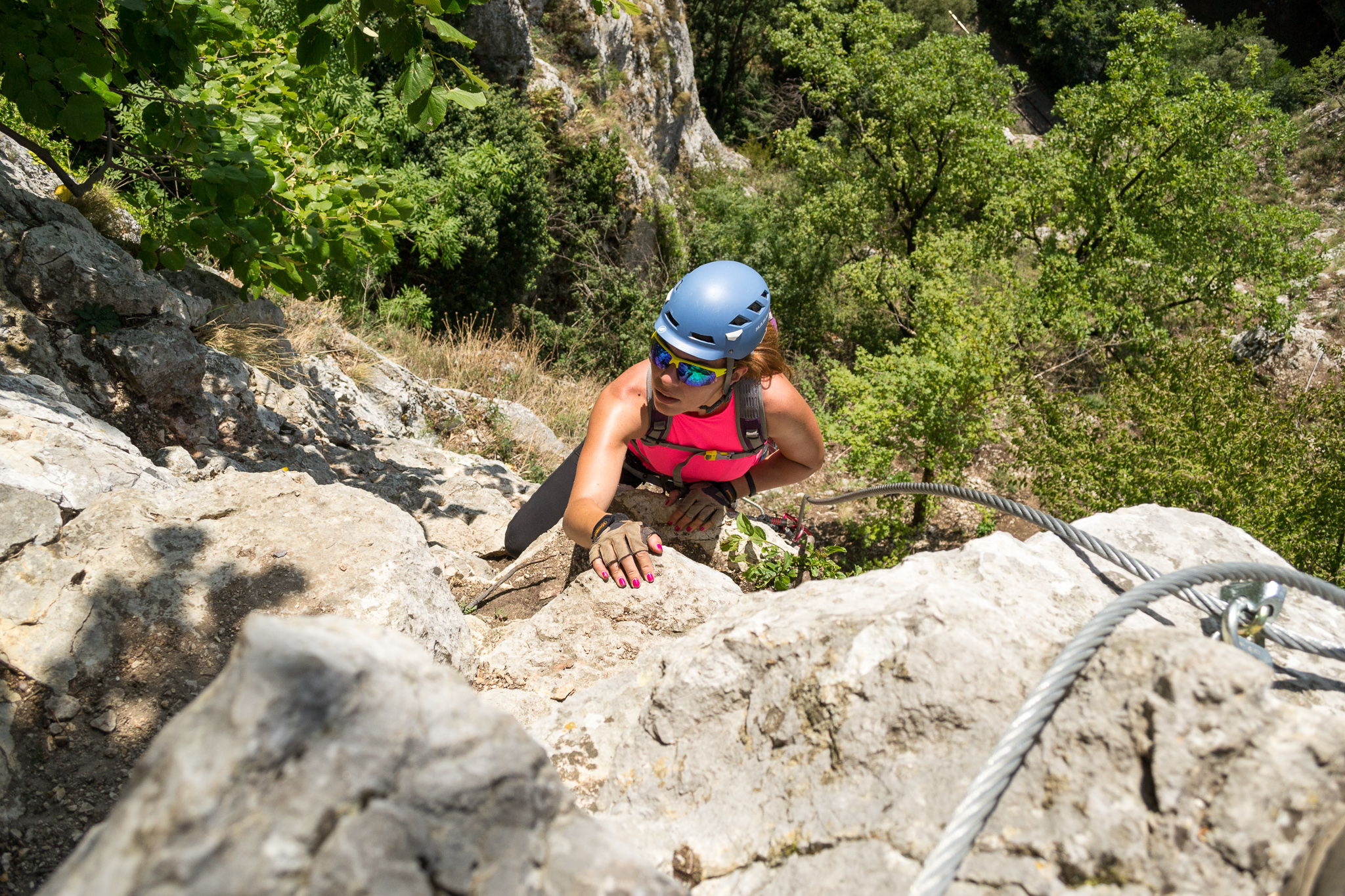
Difficulty: C (medium, but with hard sections). Grades are from A (very easy) to E (extreme). Personally, after climbing the route several times, we believe the first part contains a slightly overhanging section harder than C, making our personal rating of the entire route to be C/D.
This route has more vertical sections than the other via ferrata routes in Bihor (“Mocanita” in Vadu Crisului and Pietrele Negre, Vartop) and it offers good views over “Vama Sarii”, another landmark you go past on your way up. The upper section contains a 25m long bridge.
Duration for the via ferrata route: 1h.
Prices: free.
Mandatory gear: alpine helmet, alpine harness, via ferrata set. Optionally, gloves.
Return trail: You have two options to come back to Vadu Crisului village:
- Follow the hiking route marked with a blue circle, to the left. It will end close to the sports field where you parked.
- Follow the hiking route marked with a blue circle, to the right, to Vadu Crisului Cave and visit this interesting cave. You can then return to your car.
Wheater: Meteoblue Vadu Crisului / Viewweather Vadu Crisului.
Emergency calls: +40.SALVAMONT, which is actually +40.725.826.668, or 112, the European all around emergency number. GPS coordinates for localization: 46°58’16.4″N 22°30’48.8″E.
Video:
Photos:

Sources:
- We climbed this route
- Email talks with SJ Salvamont Salvaspeo Bihor (the local Mountain Rescue unit)
- https://www.facebook.com/salvamont.salvaspeobihor/posts/715013618707359