B ↔ 100m ↑ 80m ⏱ 20min vf / 40min total
View details in Romanian.
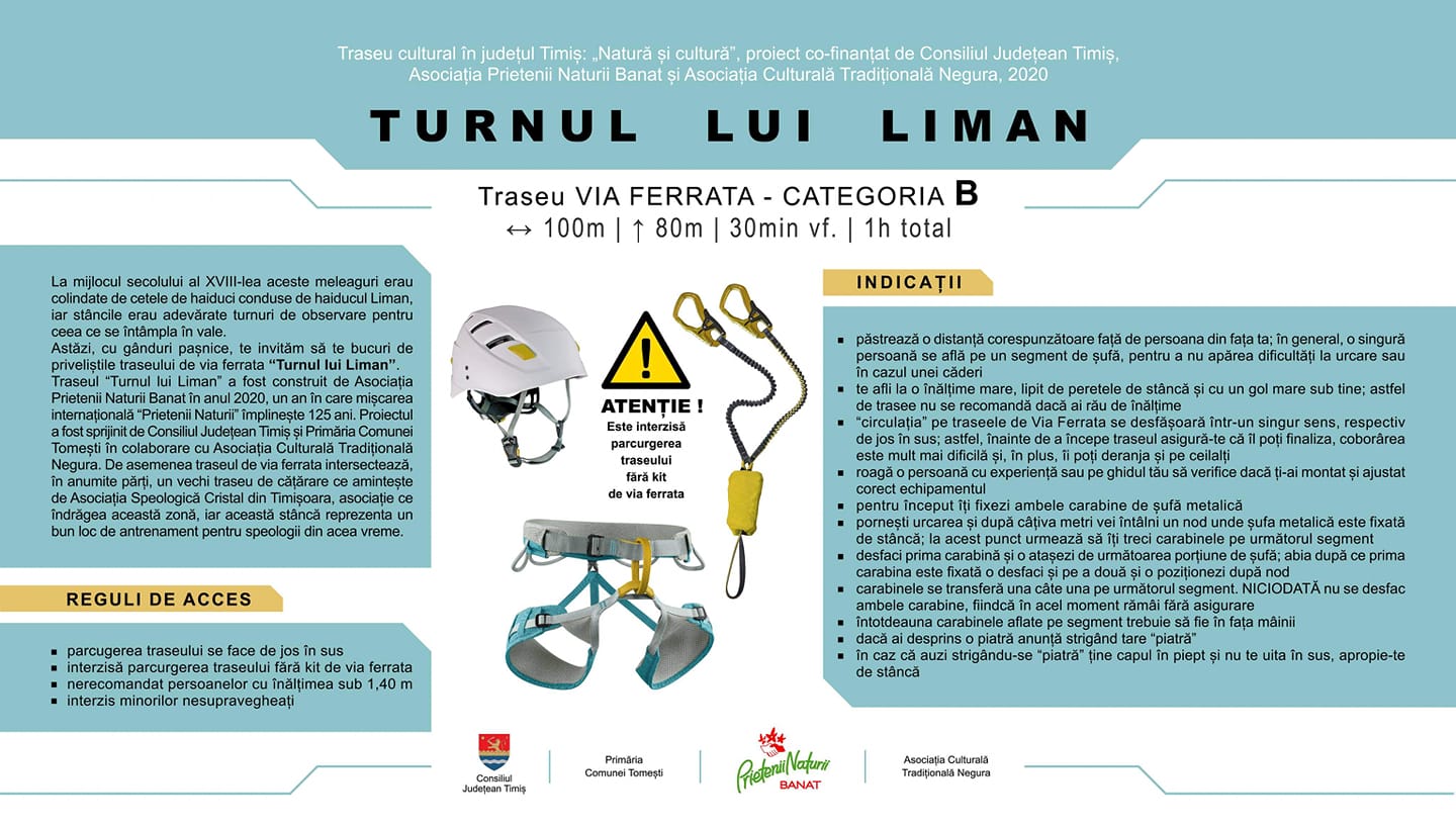
The via ferrata route called “Turnul lui Liman”, meaning Liman’s tower, was opened to the public on October 25th 2020, in Tomesti, Timis county. This route was put together by Asociatia Prietenii Naturii Banat, with support from Asociația Culturală Tradițională Negura, cofinanced by Consiliul Judeţean Timiş.
Summary:
- Length 100m
- Vertical climb 80m
- Difficulty B
- GPS access / Parking 45°45’41.7″N 22°19’21.4″E or 45.761594,22.322609 (geo)
- GPS Start Via Ferrata 45°45’41.7″N 22°19’21.4″E or 45.761594,22.322609 (geo)
- Access hiking duration: 5 min
- Via ferrata duration: 20 min
- Return hiking duration: 15 min
- Total time: 40 min
- Not recommended for persons shorter than 1.40m (4.7 feet)
- Children can go on this route only supervised and accompanied by an experienced adult
- Best time: April – October, except for when it’s rainy and the rocks become slippery
Access: The approach to this route starts from the road DJ 684, at approximately 500 meters after exiting the Village Colonia Tomesti, towards the village Luncanii de Jos. On the left side of the road you’ll see the sign pictured below, at (45°45’41.7″N 22°19’21.4″E or 45.761594, 22.322609).

The route starts by crossing the river Bega Luncanilor on an indian wire bridge, then upwards through the woods for about 1 minute. At that point you’ll find the start of the via ferrata cable, marked with an informative panel.
Length of via ferrata route: 100m. Vertical climb: 80m.
Difficulty: B (medium). Grades are from A (very easy) to E (extreme).
According to the Facebook page of this ferrata, at the middle of the 18th century, these places were roamed by local outlaws led by Liman, and these rocks were real observation towers for them.
The route consists of well equipped vertical sections, a few short traverses, and 3 good rest spots. The artificial aids alternate with natural holds, where it makes sense.
Duration for the via ferrata route: 20 min.
Prices: free.
Mandatory gear: alpine helmet, alpine harness, via ferrata set. Optionally, gloves.
Return trail: Follow the trail marked with a red triangle. In about 15 minutes you cross back the indian bridge at the start of the route.
Wheater: Meteoblue Colonia Fabricii / Viewweather comuna Tomesti.
Emergency calls: +40.SALVAMONT, which is actually +40.725.826.668, or 112, the European all around emergency number. GPS coordinates for localization: 45°45’41.7″N 22°19’21.4″E.
Video:
Photos: https://www.facebook.com/TurnuLuiLiman/photos/
Sources: