C ↔ 350m ↑ 200m ⏱ 40min vf / 3h total gpx
View details in Romanian.
The via ferrata route in Turda Gorge, Hili’s Cave, was built by the SkyFly club, from Cluj-Napoca and was first opened in the Spring of 2012.
Following some controversy, the route has been damaged (then repaired) during the years. Before proceeding on this route, it’s best you ask the local mountain rescue unit, Salvamont – Salvaspeo Cluj, about the integrity of the cable.
We last climb this route on 02.09.2017 and everything was intact.
Summary:
- GPS track – Wikiloc
- Length 350m
- Vertical climb 200m
- Difficulty C
- GPS access / Parking: 46°33’40.3″N 23°41’27.7″E or 46.561201,23.691030 (geo)
- GPS Start Via Ferrata: 46°33’56.4″N 23°40’34.3″E or 46.565667,23.676194 (geo)
- Access hiking duration: 1h30
- Via ferrata duration: 40min
- Return hiking duration: 50 min
- Total time: 3 hours
- Best time: May – October, except for when it’s rainy and the rocks become slippery
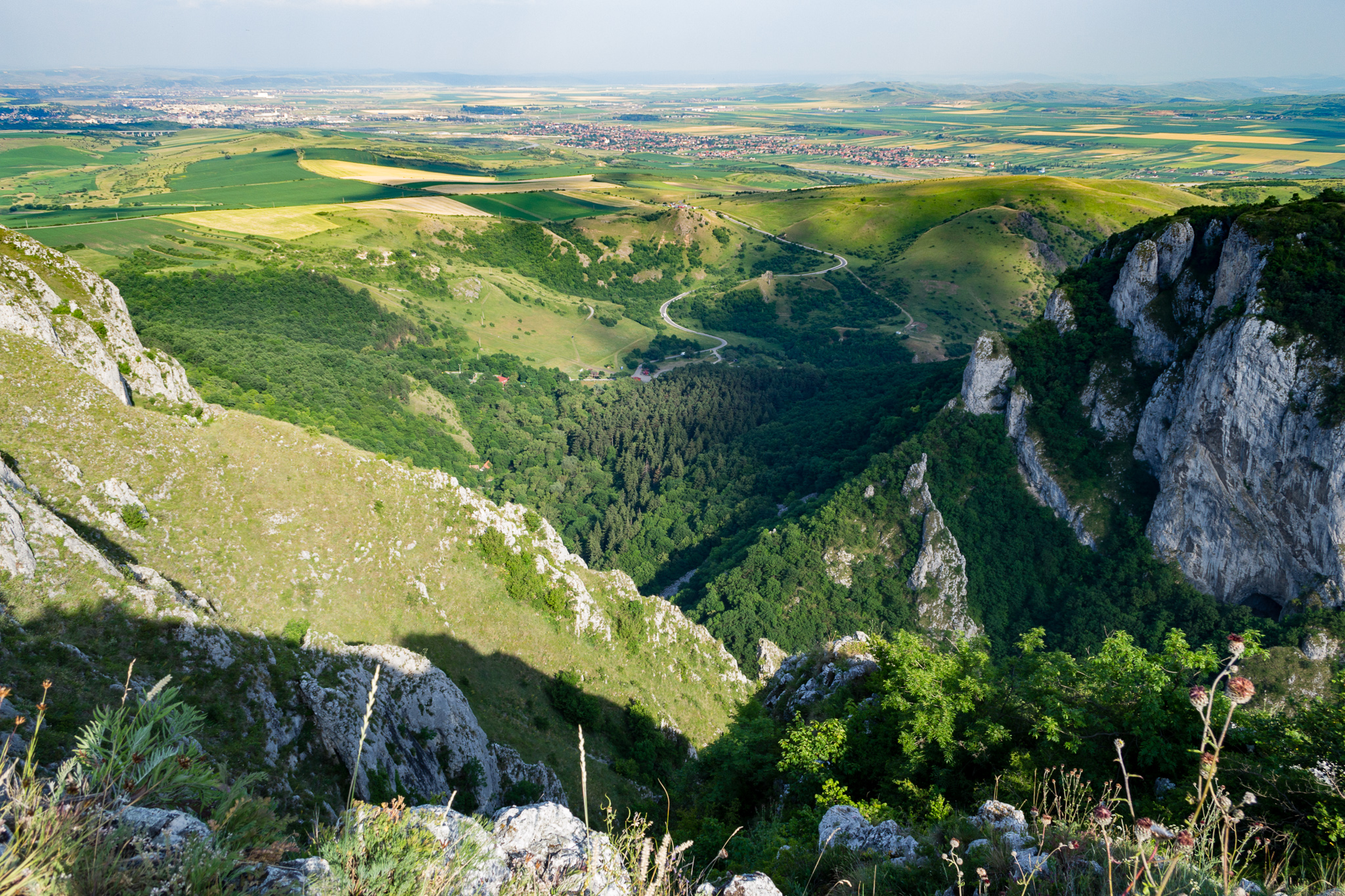
Access: Coming from Turda (12km), you continue towards the villages Mihai Viteazul, Cheia and finally, Cheile Turzii. You can park at 46°33’40.3″N 23°41’27.7″E or 46.561201,23.691030, right underneath the Salvamont hut (the local mountain rescue unit).
The access trail starts in front of the Salvamont hut (46°33’39.3″N 23°41’25.1″E or 46.560918,23.690309). You follow the sign “Cheile Turzii”. At this point, you should ask inside the Salvamont hut about the route’s integrity.
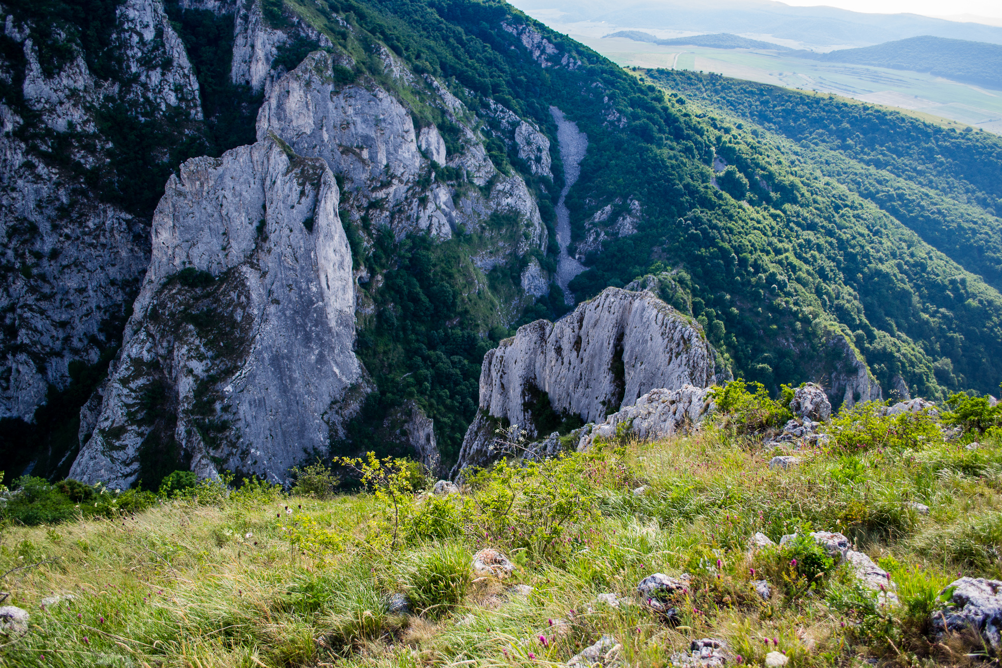
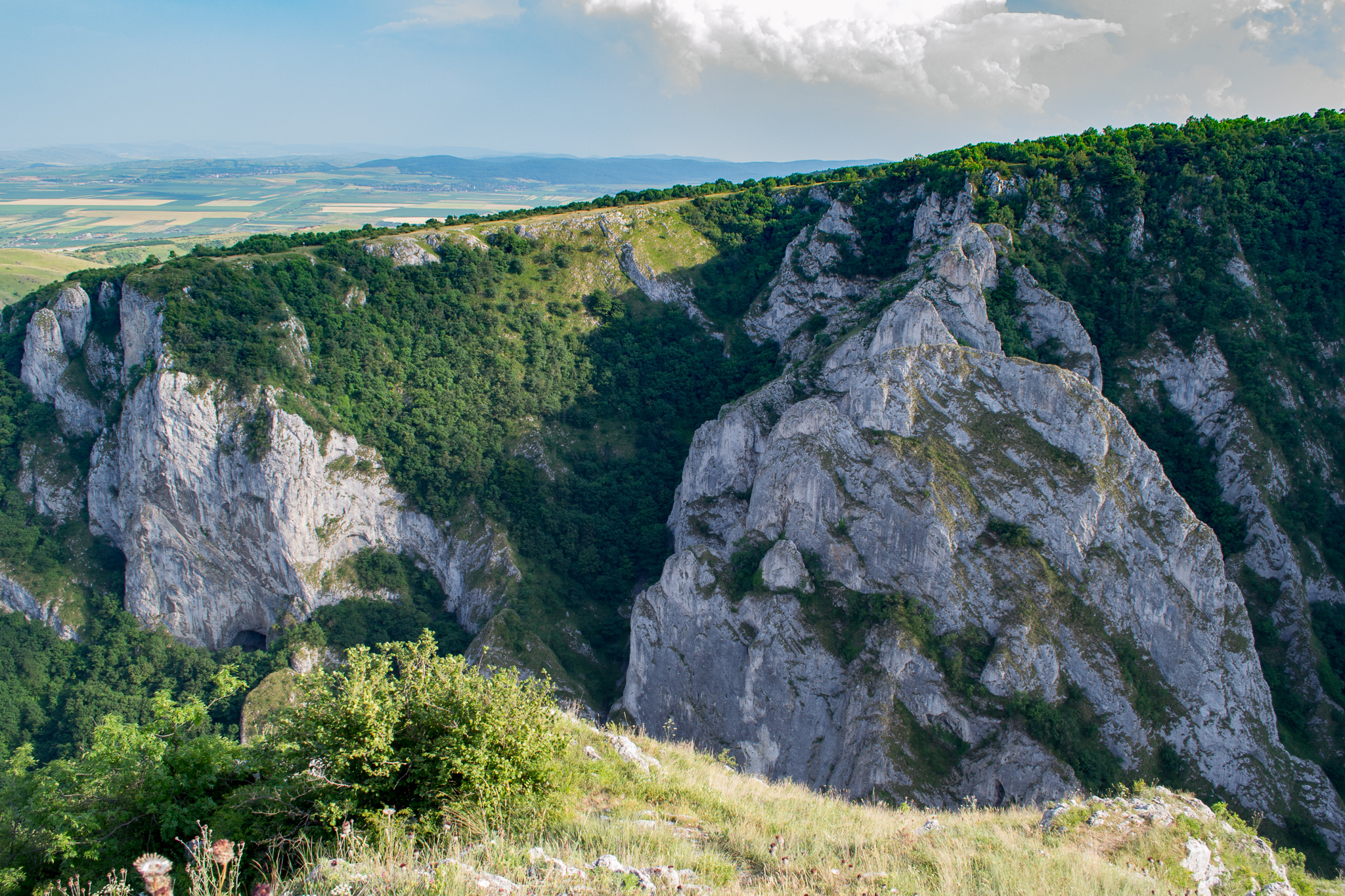
You go along the river Hășdate. You go pass the first bridge, across the second, third and fourth ones. After you cross the fourth bridge, you start to go back, but on the opposite side of the river, slowly but constantly gaining in altitude.
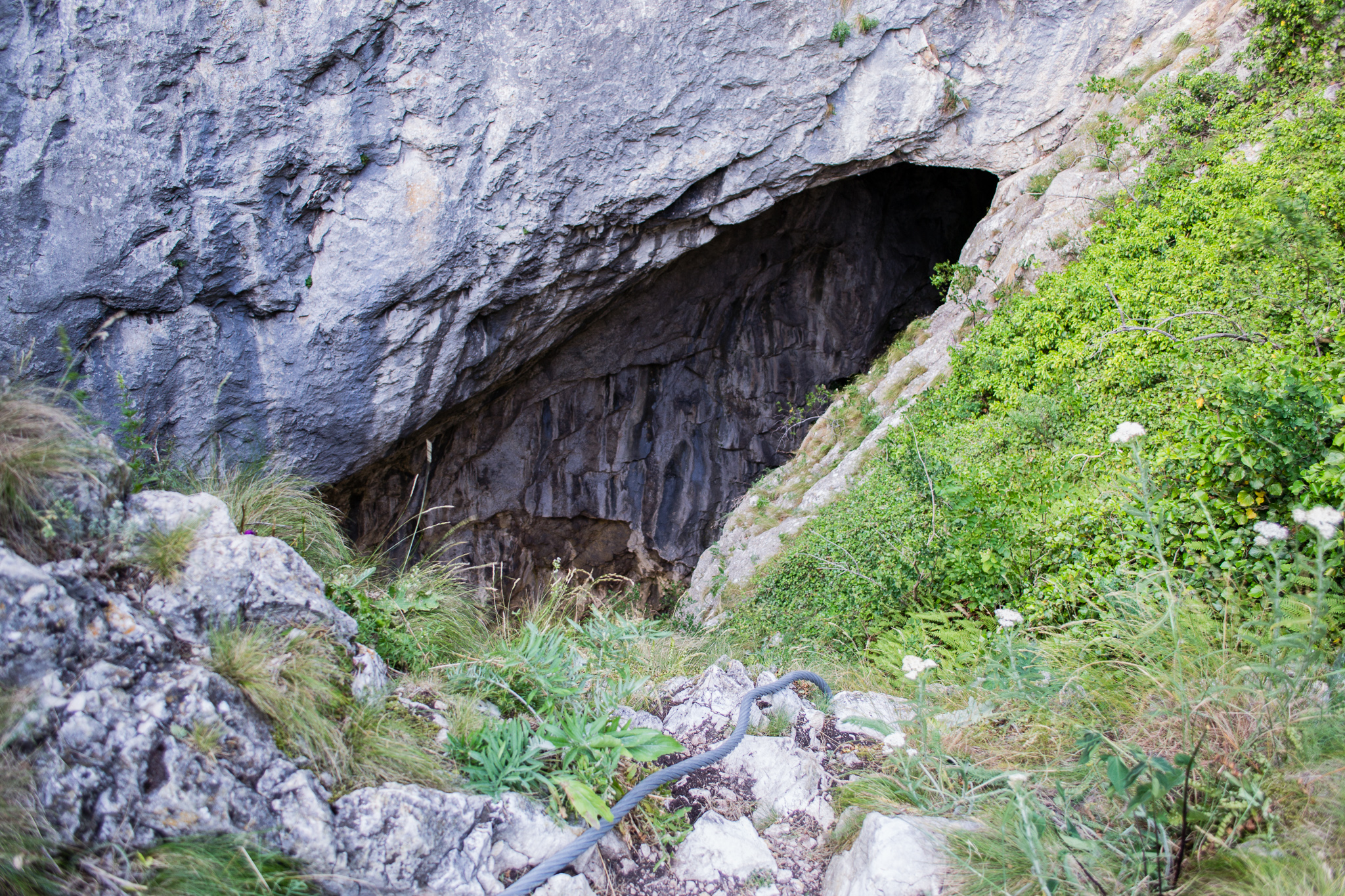
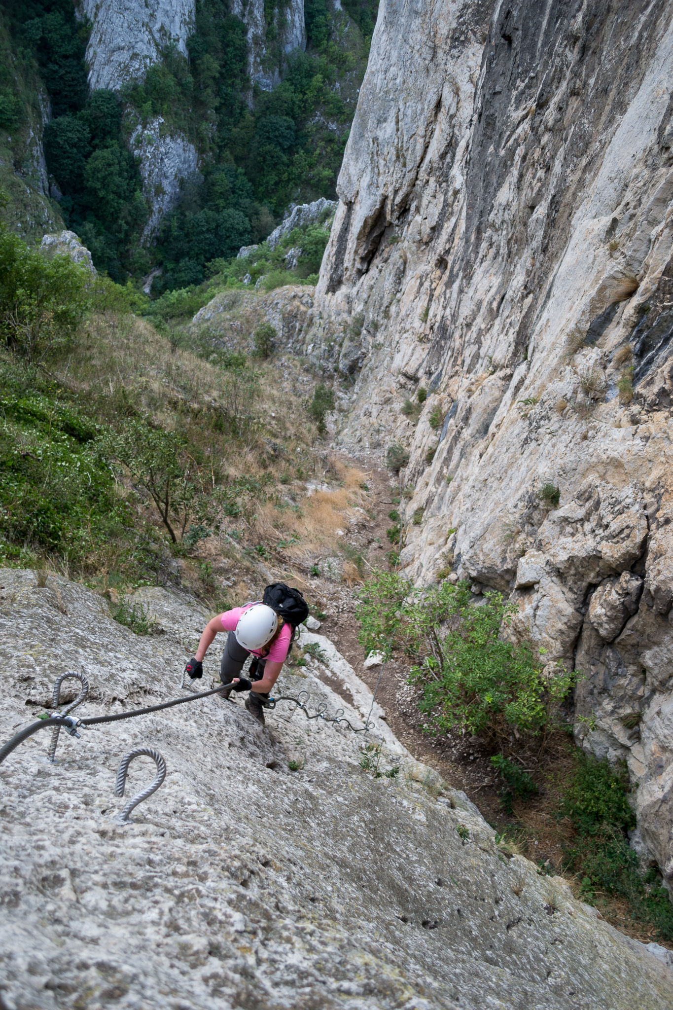
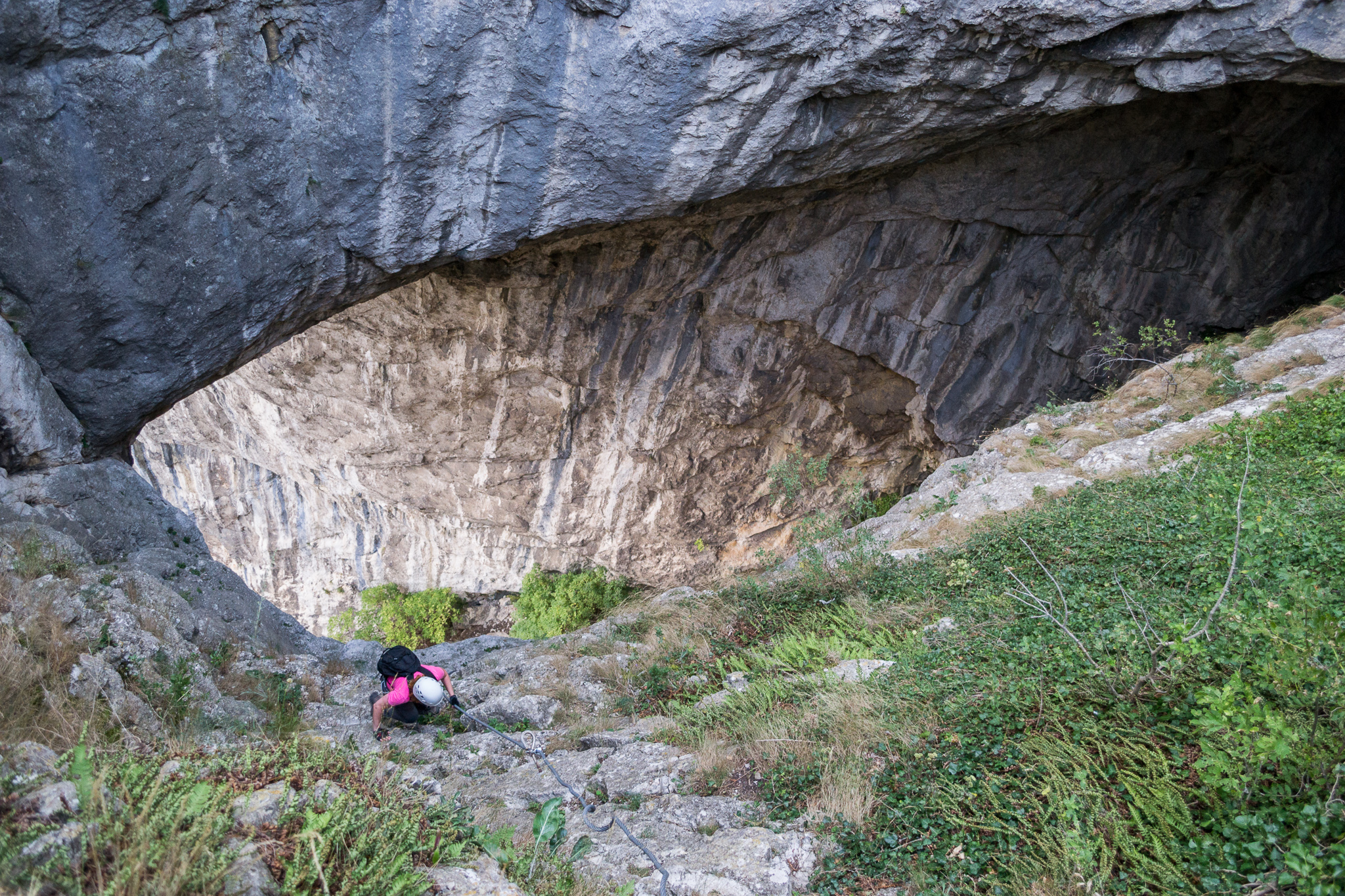
Shortly, you come to a small fork in the path. The left option goes to a small cave, but you continue on the path on the right, up to a small flat area. You can put on your via ferrata gear here, because shortly after you will reach a more exposed area, where you will notice the first cable, around 15 meters long.
After a second wall with a fixed cable, you continue on the slightly rising footpath.
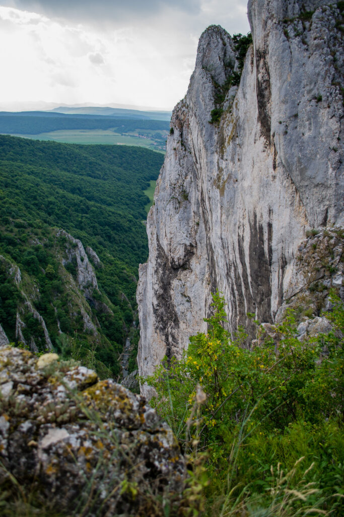
You reach a rock scree traverse and continue through it, towards the base of the stone wall. The cable starts at GPS 46°33’56.4″N 23°40’34.3″E or 46.565667,23.676194.
Length of via ferrata route: 350m. Vertical climb: 200m.
Difficulty: C (medium). Grades are from A (very easy) to E (extreme).
It is recommended to do this route in the company of experienced persons.
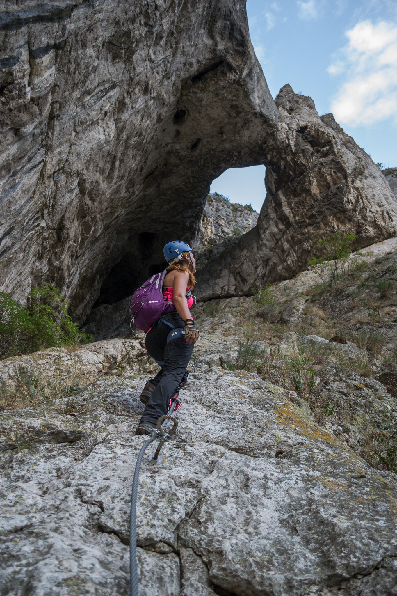
Route description: The route has few artificial holds, but many natural ones.
After the first, easier part, you reach a cave, where you can rest before the hardest part of the climb. In the cave, the route consist of one horizontal traverse to the left, a quick and more difficult vertical climb, then another horizontal traverse to the right, before the final, easier and short, vertical segment.
The last part of the route is more exposed and has no cables, but it is easier than the route so far. This section now has a cable as well.
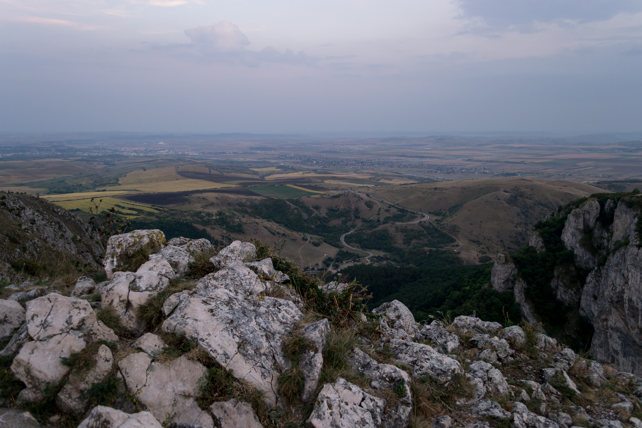
The end of the ascent is the big cross on the hill, called Crucea Sandului (the cross of Sandu).
Duration for the via ferrata route: 40min.
Prices (2022): the ferrata is free, but to enter the defile you pay 6 Lei for adults and 4 Lei for children under 14.
Mandatory gear: alpine helmet, alpine harness, via ferrata set. Optionally, gloves.
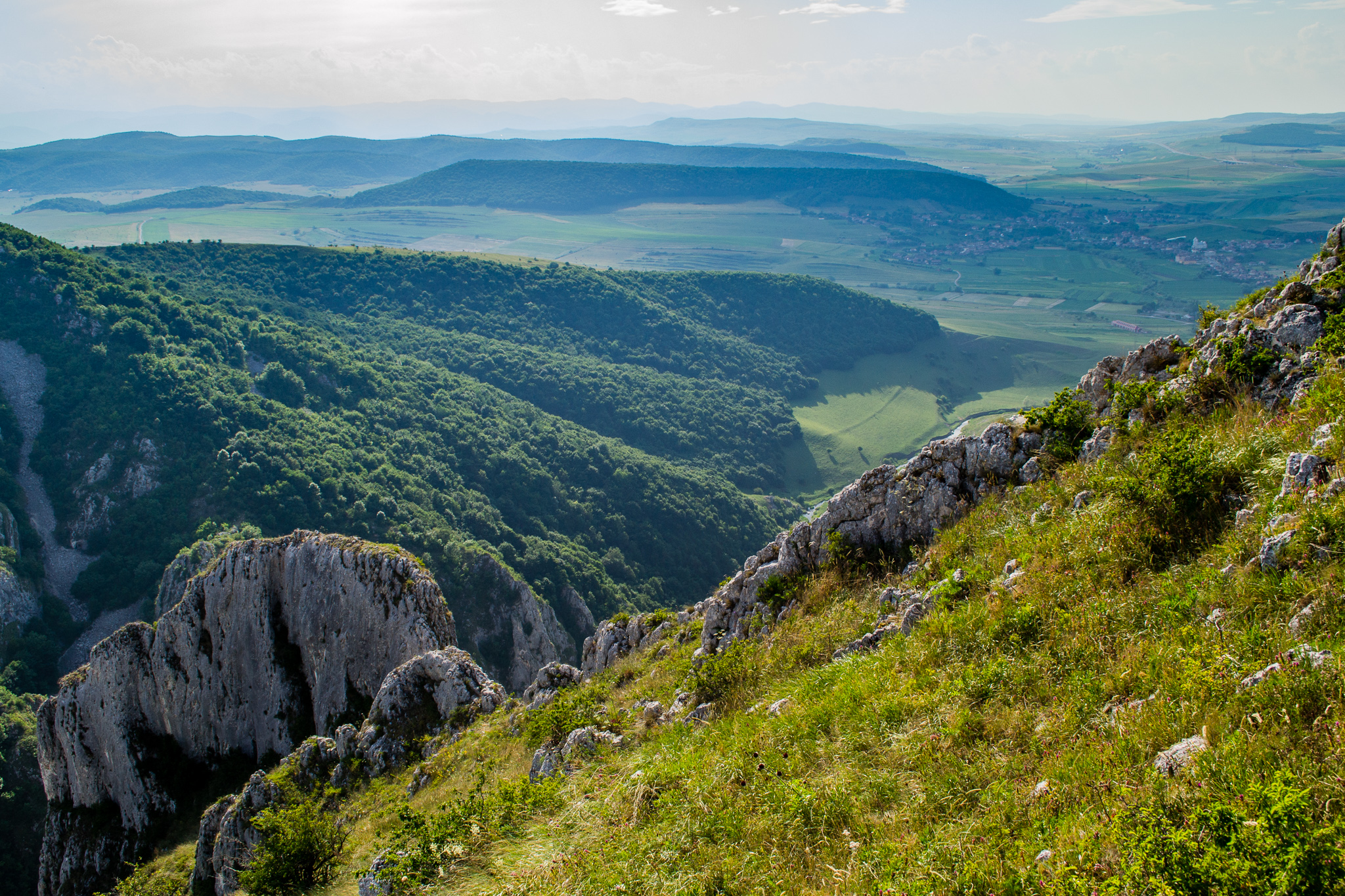
Return trail: From the cross you continue on your right, in the direction of the ascent. The crossing onto the plateau is not that obvious, but following a small footpath, you will first go down a bit, then climb back onto the plateau. Take your time here and find the correct exit.
From the plateau, in order to go back to the starting point, via Turda hut, you will follow the hiking trail marked with a red dot, through an oak forest. The return trail takes about 40 minutes. In August 2019 there were new, clear, trail markers installed.
Wheater: Meteoblue Cheia, Cluj / Viewweather Cheia, Cluj.
Emergency calls: +40.SALVAMONT, which is actually +40.725.826.668, or 112, the European all around emergency number. GPS coordinates for localization: 46°33’56.4″N 23°40’34.3″E or 46.565667,23.676194.
Video:
Photos:

Sources:
- We climbed this route several times
- https://www.travelguideromania.com/ro/traseul-de-via-ferrata-din-cheile-turzii/
- https://www.facebook.com/profile.php?id=100063512532394
Controversy: