B ↔ 150m ↑ 120m ⏱ 30min vf / 1h15 total
View details in Romanian.
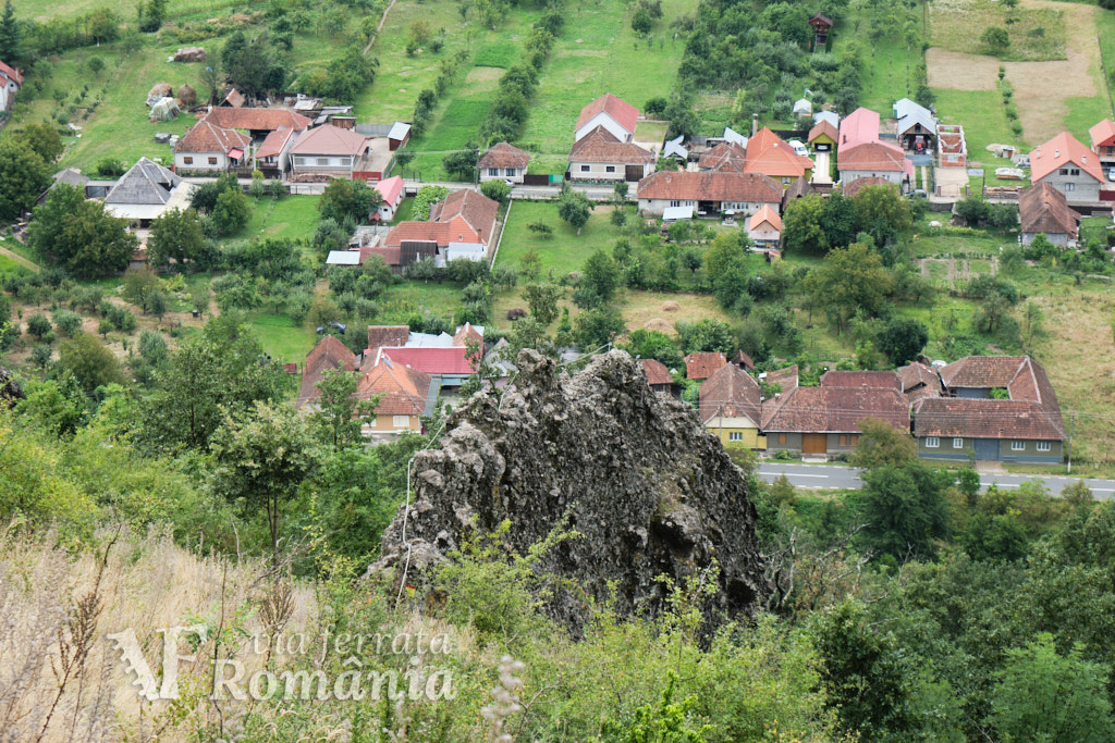
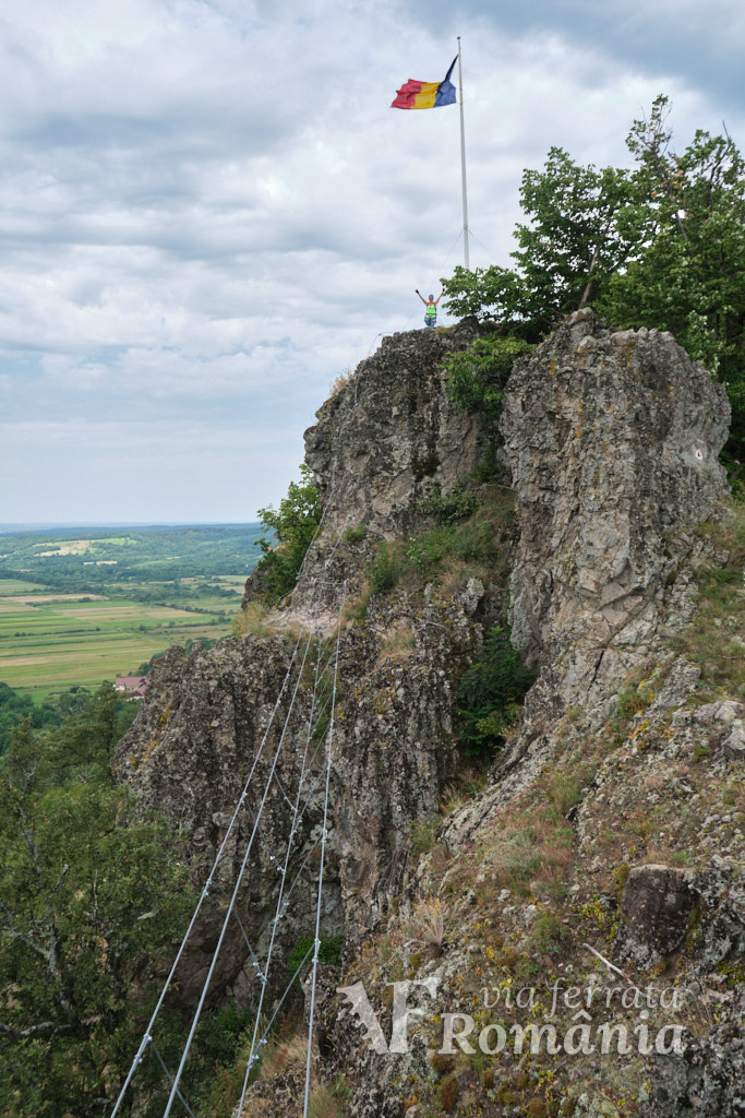
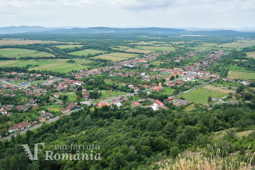
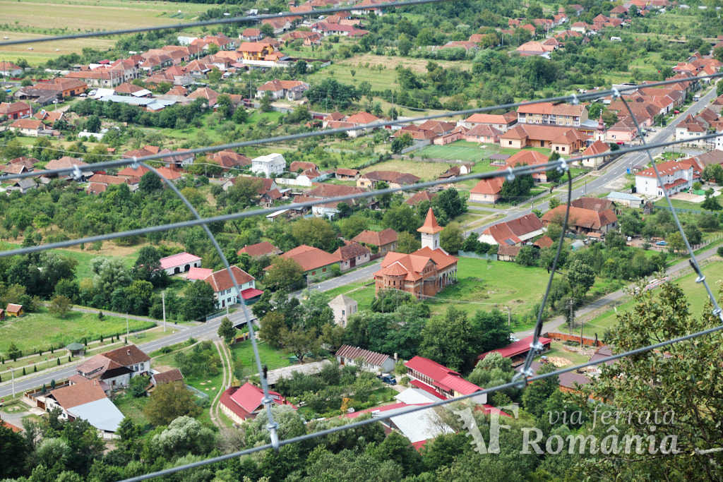
“Cetate Dezna” is a short via ferrata route, opened to the public in September 2022. It is built on the rocks below the ruins of Dezna Fortress, situated above village Dezna, in Arad county, at an altitude of about 330m. Cetate means fortress in Romanian.
Summary:
- Vertical climb 120m
- Difficulty B
- GPS access / Parking 46°24’21.1″N 22°15’16.9″E or 46.406049,22.254728 (geo)
- GPS Start Via Ferrata 46°24’28.9″N 22°15’10.9″E or 46.408023,22.253030 (geo)
- Access hiking duration: 15 min
- Via ferrata duration: 30 min
- Return hiking duration: 30 min
- Total time: 1h15
- Best time: April – October, except for when it’s rainy and the rocks become slippery
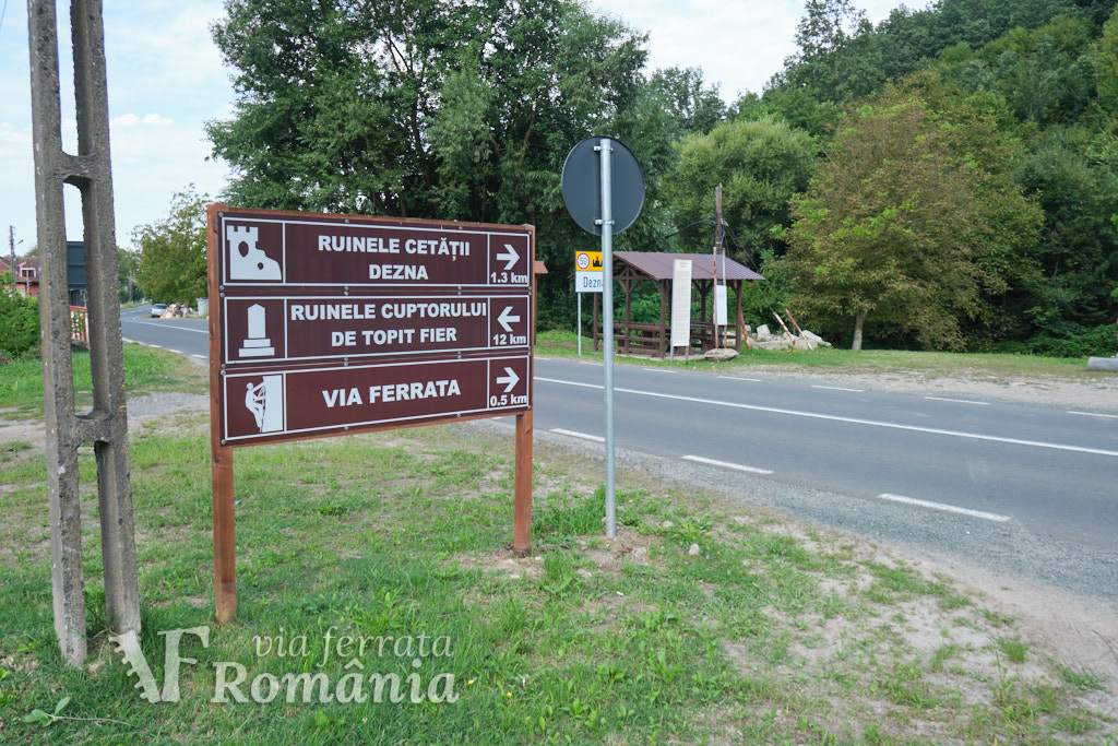
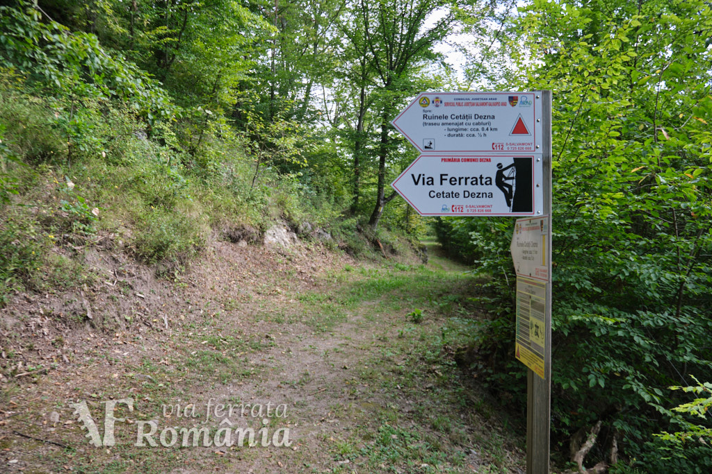
Access: Right after exiting village Dezna towards Rănușa / Moneasa, there is a small car parking – 46°24’21.8″N 22°15’17.0″E or 46.406049,22.254728. Here we can find an info board with the map of the area, the hiking routes up to Dezna Fortress and a short history of the fortress.
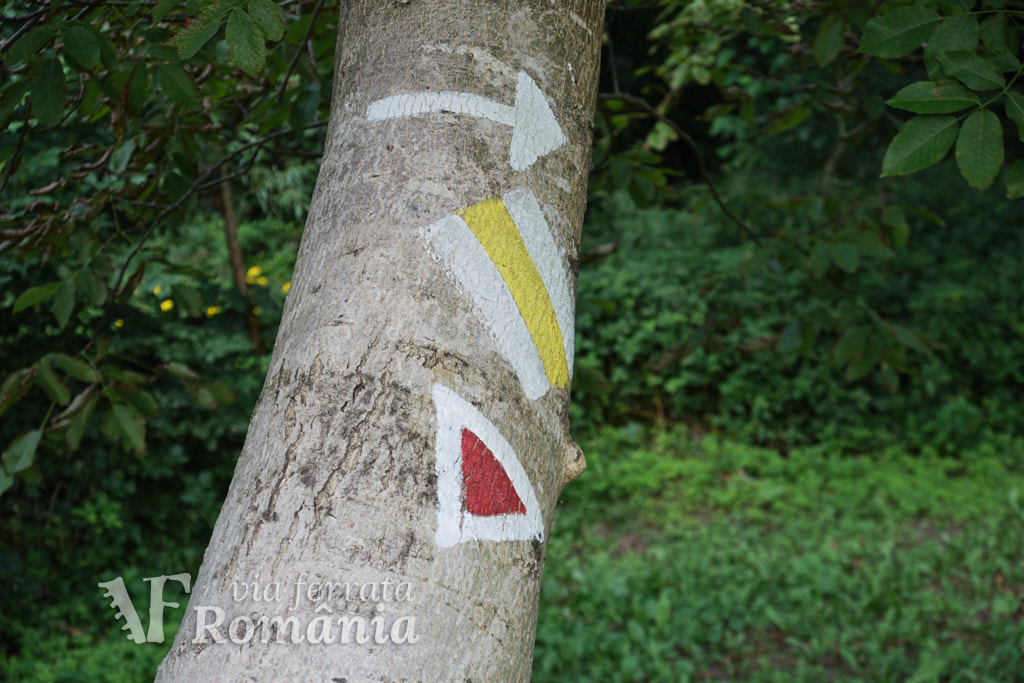
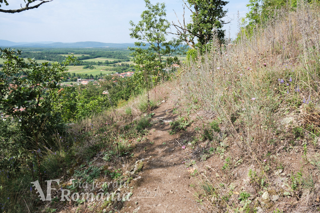
We start uphill on the hiking trail marked with a red triangle. The first part is shared with the yellow band trail, but soon the two routes split and we turn left.
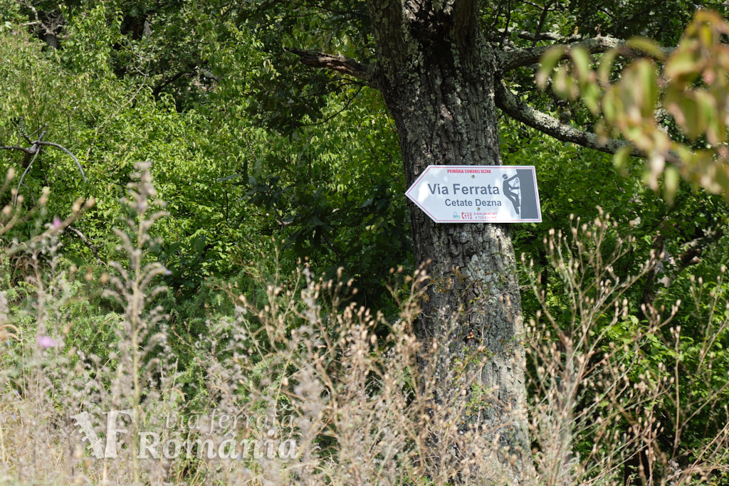
The red triangle trail continues with a few sections secured with cables, but you are still on the hiking trail at this point. We leave this trail and turn left again when we see a sign on a tree trunk, pointing towards the via ferrata start. This last part is an unmarked traverse, where, at the end of it, you’ll see the start of the cable.
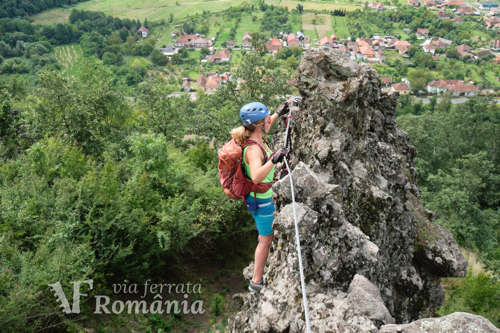
Length of via ferrata route: 150m. Vertical climb: n/a; total vertical 120m.
Difficulty: B (easy). Grades are from A (very easy) to E (extreme).
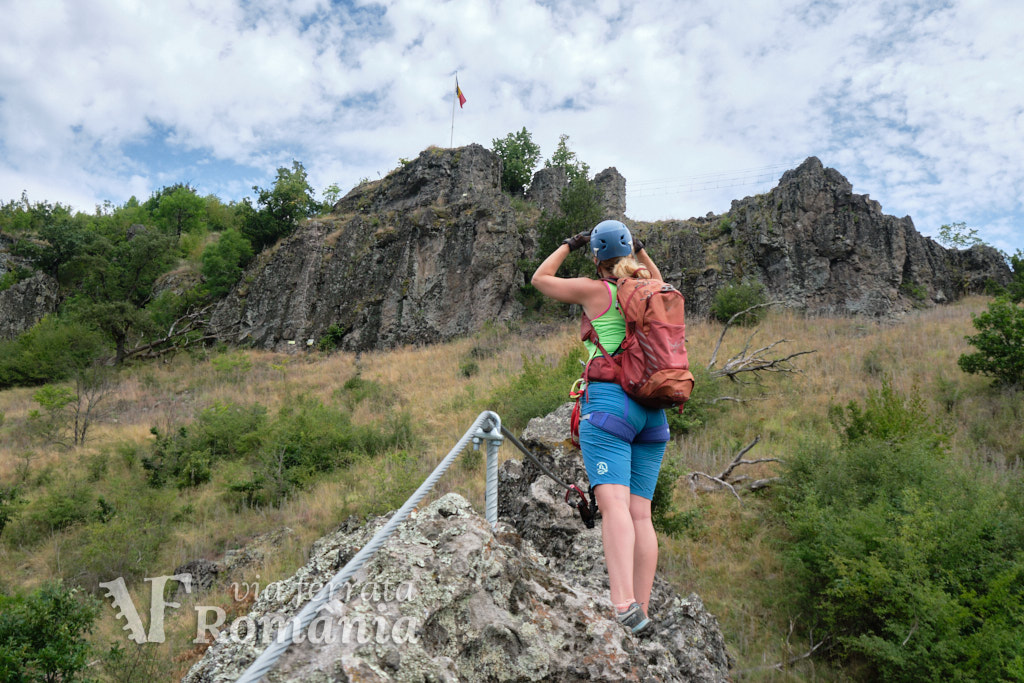
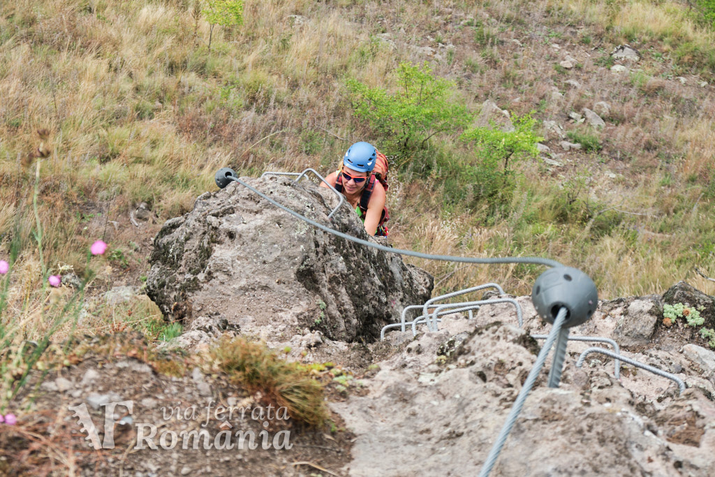
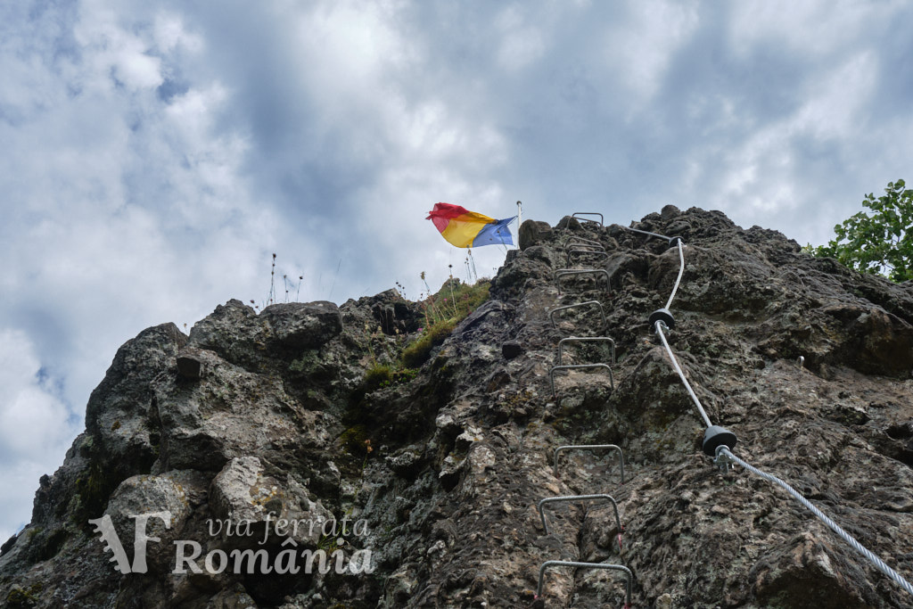
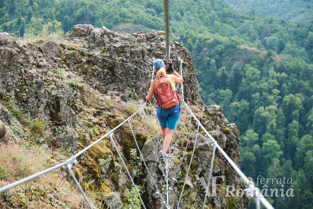
The via ferrata part of the route is short and is made up of two sectors with plenty of metal stairs. After the first vertical sector, we can already see the final bridge and the flag at the top of the fortress ruins. The 25 meters long bridge, part of sector 2, can also be skipped entirely if we go straight up to the top of the ruins.
Duration for the via ferrata route: approximately 30 minutes.
Prices: free.
Mandatory gear: alpine helmet, alpine harness, via ferrata set. Optionally, gloves.
The builders of this route, S.C. Transilvania Cave Diving S.R.L., also rent equipment.
Return trail: Follow the hiking trail marked with a red triangle for about 30 minutes, back to the starting point. Alternatively, you can use the yellow band trail, which is less steep and takes you to the same initial car parking.
Wheater: Meteoblue sat Dezna / Viewweather sat Dezna.
Emergency calls: 0-SALVAMONT, which is actually +40.725.826.668, or 112, the European all around emergency number.
Video:
Photos:
Sources: